Forêt de Saint-Arnoult
Located in Seine-Maritime, Normandy Coordinates: 49°32′36″ N 0°41′30″ E
- Elevation
- 65 m
- above sea level
- Local time
- UTC+01:00
- Europe/Paris · UTC+01:00
About Forêt de Saint-Arnoult
Forêt de Saint-Arnoult is a natural site. Location: Seine-Maritime, Normandy.
In comparison
- 5 sights and natural places within 10 km Chateau de Louvetot, Brotonne Bridge
Nearest towns and villages
-
Saint-Arnoult Village, Arrondissement de Rouen2.4 km SW
-
Rives-en-Seine Village, Arrondissement de Rouen3.1 km SE
-
Maulévrier-Sainte-Gertrude Village, Arrondissement de Rouen2.5 km NE
-
Saint-Arnoult Village, Saint-Arnoult2.4 km SW
-
Caudebec-en-Caux Village, Rives-en-Seine3.1 km SE
-
Maulévrier-Sainte-Gertrude Village, Maulévrier-Sainte-Gertrude3.1 km E
Nearby attractions & nature
Everything nearby-
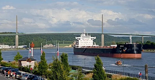 Brotonne Bridge Landmark, Rives-en-Seine4.7 km SE
-
Pâture du Mort Natural site, Seine-Maritime7 km SE
-
Chateau de Louvetot Historic site, Louvetot4.1 km NE
-
Forêt du Trait Natural site, Seine-Maritime11 km SE
-
Forêt de Brotonne Natural site, Seine-Maritime12 km S
-
Abbaye de Saint-Wandrille Attraction, Rives-en-Seine5.8 km E
-
Forêt de Jumièges Natural site, Seine-Maritime17 km SE
-
Bois de la Hèse Natural site, Seine-Maritime17 km W
Sources & licences
Data last updated: