Spitalwald
Located in Baden-Wurttemberg, Germany Coordinates: 48°43′00″ N 9°42′00″ E
- Elevation
- 407 m
- above sea level
- Local time
- UTC+01:00
- Europe/Berlin · UTC+01:00
About Spitalwald
Spitalwald is a natural site. Location: Baden-Wurttemberg, Germany.
In comparison
- 64 sights and natural places within 10 km Wachtert, Krumm
Nearest towns and villages
-
Eislingen/Fils Village, Landkreis Göppingen2.4 km S
-
Landkreis Göppingen Municipality, Regierungsbezirk Stuttgart3.9 km SE
-
Göppingen Village, Landkreis Göppingen3.7 km SW
-
Eislingen Town, Eislingen/Fils2.4 km S
-
Ottenbach Village, Landkreis Göppingen4.2 km NE
-
Salach Village, Landkreis Göppingen4.4 km SE
Nearby attractions & nature
Everything nearby-
Wachtert Mountain, Göppingen<0.1 km N
-
Hörnle Mountain, Göppingen1.9 km NE
-
Oberholz Natural site, Baden-Wurttemberg2.5 km W
-
Hohenstaufen Mountain, Göppingen3.1 km N
-
Reuteberg Mountain, Göppingen3.9 km S
-
Katzenbach River, Baden-Wurttemberg3.1 km SW
-
Krumm River, Baden-Wurttemberg1.9 km S
-
Asberg Mountain, Ottenbach3.7 km E
More nature in Germany
-
Rehgebirge Mountain, Baden-Wurttemberg5.2 km E
-
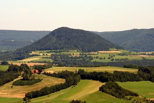 Stuifen Mountain, Waldstetten9.2 km E
-
Greut Mountain, Göppingen5.2 km SW
-
Sielenwang Mountain, Bad Ditzenbach10 km S
-
Nameless Point Mountain, Donzdorf8.4 km E
-
Eichert Natural site, Baden-Wurttemberg5.2 km SW
Sources & licences
Data last updated: