Dreistelzberg
Located in Bavaria, Germany Coordinates: 50°16′36″ N 9°46′05″ E
- Elevation
- 660 m
- above sea level
- Local time
- UTC+01:00
- Europe/Berlin · UTC+01:00
About Dreistelzberg
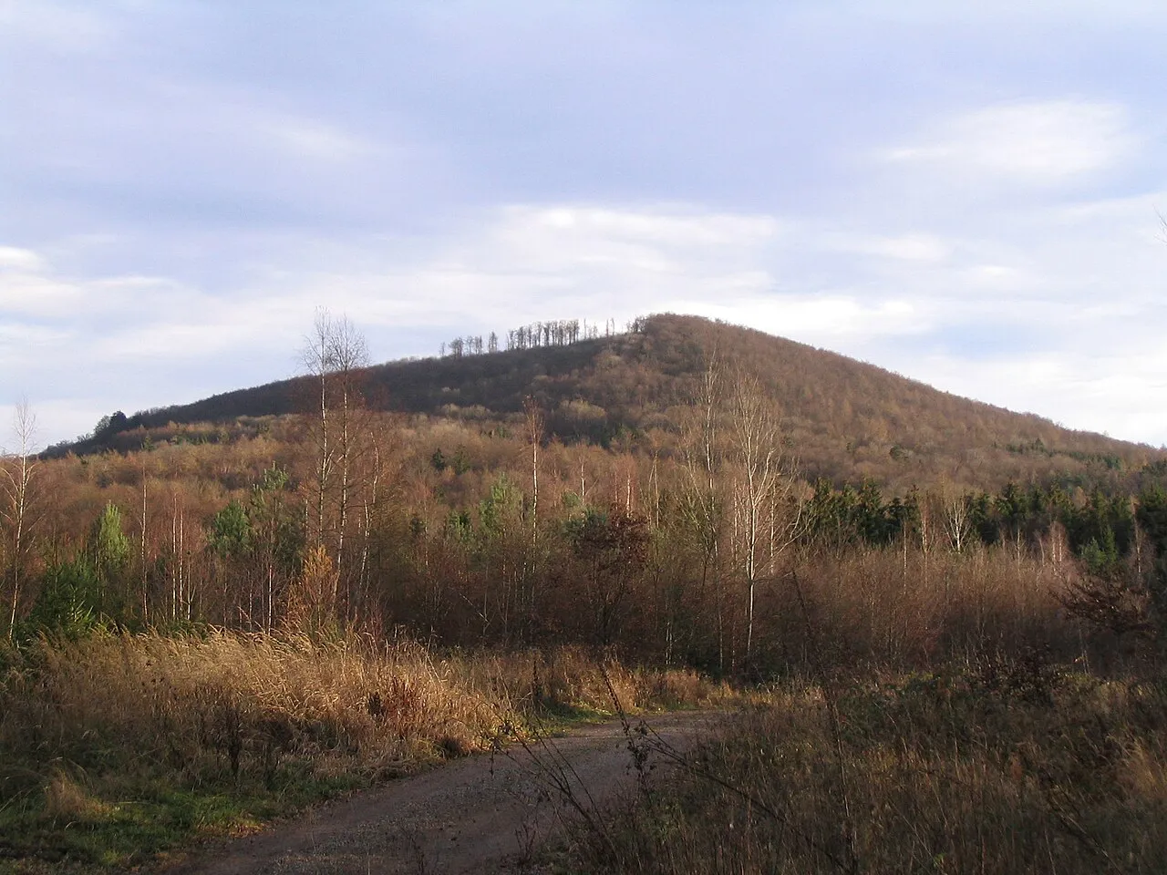
Dreistelzberg is a mountain. Location: Bavaria, Germany. Elevation: 660 m.
The Dreistelzberg, also called the Dreistelzkopf and frequently shortened to Dreistelz, is a mountain, 660.4 m above sea level (NHN), in the Bavarian part of the Rhön Mountains. The mountain is not one of the highest Rhön peaks, but thanks to its rather isolated location on the southwestern edge of the range it has a striking appearance, rising prominently above its surroundings.
Read more on Wikipedia Text: Wikipedia contributors · CC BY-SA 4.0 · shortened
At a glance
- Length
- 0.4 km
- Area
- 16 ha
Source: Wikidata
In comparison
- No. 4062 of 25787 mountains in Germany by elevation
- 56 sights and natural places within 10 km Hagküppel, Sinnberg
Nearest towns and villages
-
Oberleichtersbach Village, Landkreis Bad Kissingen2.4 km E
-
Oberleichtersbach Village, Oberleichtersbach2.4 km E
-
Bad Brückenau Village, Landkreis Bad Kissingen3.9 km N
-
Dreistelzhof Village, Oberleichtersbach0.8 km NE
-
Modlos Village, Oberleichtersbach1.3 km S
-
Buchrasen Village, Oberleichtersbach1.8 km NE
Nearby attractions & nature
Everything nearby-
Hagküppel Mountain, Zeitlofs, Markt1.3 km SW
-
Sinnberg Mountain, Bad Brückenau2.2 km N
-
Seelwald Natural site, Bavaria2.4 km W
-
Apfelberg Mountain, Bavaria3.5 km S
-
Fonsberg Mountain, Sinntal3.6 km NW
-
Mäusberg Mountain, Zeitlofs, Markt3.7 km S
-
Krechenberg Mountain, Sinntal5 km W
-
Dürrsberg Mountain, Zeitlofs, Markt5 km SW
More nature in Germany
-
Kälber Berg Mountain, Bavaria5.7 km W
-
Griesberg Mountain, Zeitlofs, Markt6.3 km W
-
Querberg Mountain, Bavaria6.7 km S
-
 Platzer Kuppe Mountain, Geroda, Markt11 km E
-
Großer Sommerberg Mountain, Bavaria7.5 km SW
-
Hartwald Natural site, Bavaria4.2 km N
Sources & licences
Data last updated: · 2 independent sources