Schneeberg
Located in Bavaria, Germany Coordinates: 50°03′07″ N 11°51′16″ E
- Elevation
- 1,051 m
- above sea level
- Local time
- UTC+01:00
- Europe/Berlin · UTC+01:00
About Schneeberg
Schneeberg is a mountain. Location: Bavaria, Germany. Elevation: 1,051 m.
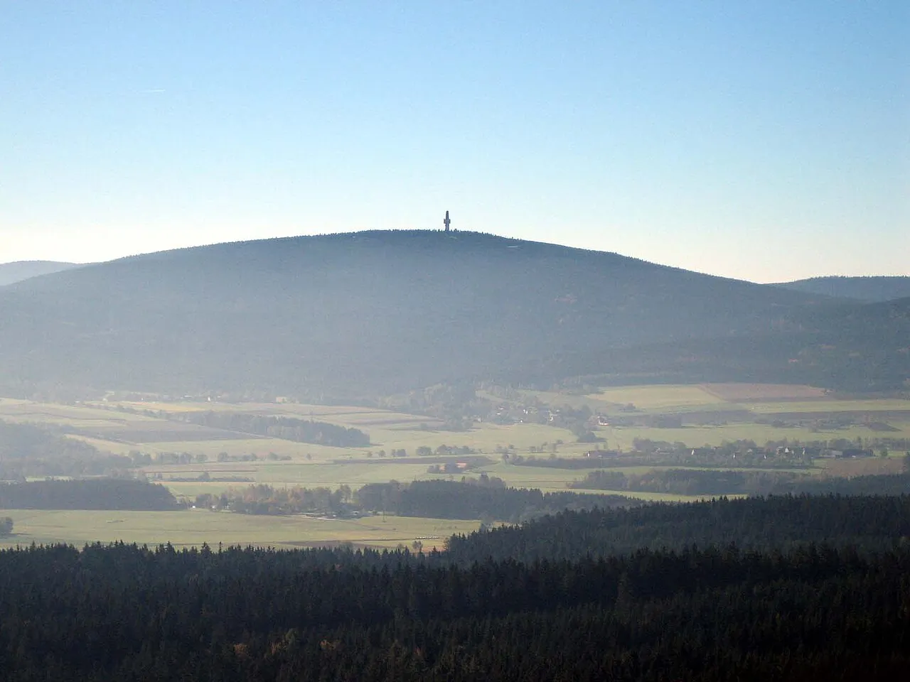
Schneeberg (German pronunciation: [ˈʃneːbɛʁk] ; 1,051 m above sea level (NN)) is the highest mountain in the Fichtel Mountains, a mountain range in Upper Franconia in northeast Bavaria, Germany. It can be readily identified from a distance by its squat tower - a relic of the Cold War. The summit comprises a jumble of granite rocks and a rock pillar (Felsburg) on which the Backöfele observation tower stands and is still dominated by the relics of military installations including its Cold War listening post.
Read more on Wikipedia Text: Wikipedia contributors · CC BY-SA 4.0 · shortened
At a glance
- Topographic prominence
- 484 m
Source: Wikidata
In comparison
- No. 1389 of 25787 mountains in Germany by elevation
- 63 sights and natural places within 10 km Nußhardt, Paschenbach
Nearest towns and villages
-
Bischofsgrün Village, Landkreis Bayreuth4.4 km W
-
Bischofsgrün Village, Bischofsgrün3.9 km W
-
Weißenstadt Village, Landkreis Wunsiedel im Fichtelgebirge5.9 km N
-
Fichtelberg Village, Landkreis Bayreuth5.5 km S
-
Fichtelberg Village, Fichtelberg5.5 km S
-
Bad Weißenstadt Village, Weißenstadt6.1 km NE
Nearby attractions & nature
Everything nearby-
Nußhardt Mountain, Bavaria1.5 km SE
-
Paschenbach River, Landkreis Bayreuth1.9 km SW
-
Schauberg Mountain, Bavaria2.4 km E
-
Seehügel Mountain, Bavaria2.7 km SE
-
Rudolfstein Mountain, Weißenstadt2.7 km NE
-
Egerquelle Natural site, Landkreis Wunsiedel im Fichtelgebirge3.2 km NW
-
Weißmainquelle Natural site, Landkreis Bayreuth3.3 km SW
-
Fichtelnaabquelle Natural site, Landkreis Bayreuth3.3 km SW
Sources & licences
Data last updated: · 2 independent sources