Dachau
Located in Landkreis Dachau, Upper Bavaria Coordinates: 48°15′43″ N 11°26′43″ E
- Population
- 47,138
- 47.1K
- Elevation
- 478 m
- above sea level
- Local time
- UTC+01:00
- Europe/Berlin · UTC+01:00
- Places inside
- 22
- listed under Dachau
About Dachau
Dachau is a village. Location: Landkreis Dachau, Upper Bavaria. Population: 47,138. Elevation: 478 m.
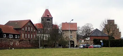
Dachau (German pronunciation: [ˈdaxaʊ] ) is a town in the Upper Bavaria district of Bavaria, a state in the southern part of Germany. It is a major district town—a Große Kreisstadt—of the administrative region of Upper Bavaria, about 20 kilometres (12 miles) north-west of Munich. It is now a popular residential area for people working in Munich, with roughly 45,000 inhabitants. The historic centre of town with its 18th-century castle is situated on an elevation and visible over a great distance.
Read more on Wikipedia Text: Wikipedia contributors · CC BY-SA 4.0 · shortened
At a glance
- Area
- 35 km²
Source: Wikidata
In comparison
- Most populous of 17 places in Landkreis Dachau
- Nearest larger town: Landkreis Dachau, 10 km NW
- 40 sights and natural places within 10 km Gröbenbach, Dachau Concentration Camp (Fleischwarenfabrik Hans Wülfert)
- Listed here: Village: 14, Historic site: 7, Town: 1
Places in Dachau
22 places-
Dachau Town39.7K
-
Pellheim Village326
-
Assenhausen Village
-
Dachau concentration camp Historic site
-
Dachau Concentration Camp Historic site
-
Dachau Concentration Camp (Pollnhof) Historic site
-
Dachau Concentration Camp (Präzifix) Historic site
-
Early Camp Dachau Historic site
-
Eisingertshofen Village
-
Etzenhausen Village
-
Liebhof Concentration Camp Historic site
-
Lohfeld Village
-
Mitterndorf Village
-
Oberaugustenfeld Village
-
Obergrashof Village
-
Polln Village
-
Pullhausen Village
-
Steinkirchen Village
-
Udlding Village
-
Unteraugustenfeld Village
-
Webling Village
Nearby attractions & nature
Everything nearby-
Gröbenbach River, Bavaria0.5 km SW
-
 Early Camp Breitenau Historic site, Bergkirchen3.3 km W
-
Maisach River, Bavaria2.6 km W
-
Würm River, Bavaria3.3 km NE
-
Saubach River, Bavaria3.8 km E
-
Karlsfeld Concentration Camp Historic site, Karlsfeld4.2 km SE
Sources & licences
Data last updated: · 2 independent sources