Frauenberg
Located in Eichstätt, Landkreis Eichstätt Coordinates: 48°53′10″ N 11°10′44″ E
- Elevation
- 504 m
- above sea level
- Local time
- UTC+01:00
- Europe/Berlin · UTC+01:00
About Frauenberg
Frauenberg is a mountain. Location: Eichstätt, Landkreis Eichstätt. Elevation: 504 m.
In comparison
- No. 8506 of 25787 mountains in Germany by elevation
- 32 sights and natural places within 10 km Frauenbergkapelle, Eichstätter Dom
Nearest towns and villages
-
Eichstätt Town, Eichstätt1.3 km E
-
Roman Catholic Diocese of Eichstätt Village, Eichstätt0.7 km NE
-
Rebdorf Village, Eichstätt0.7 km W
-
Marienstein Village, Eichstätt1.3 km NW
-
Wasserzell Village, Eichstätt1.5 km SW
-
Blumenberg Village, Eichstätt2.4 km NW
Nearby attractions & nature
Everything nearby-
Frauenbergkapelle Attraction, Eichstätt<0.1 km NW
-
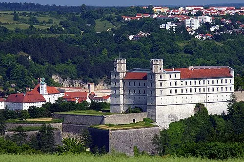 Willibaldsburg Historic site, Eichstätt1.3 km NW
-
Eichstätter Dom Attraction, Eichstätt0.7 km NE
-
Mariasteiner Brauschlag Natural site, Bavaria2.3 km SW
-
Museum für Ur- und Frühgeschichte Eichstätt Museum, Eichstätt1.1 km NW
-
Willibaldsberg Castle Historic site, Eichstätt1.2 km NW
-
Sulzbuck Natural site, Bavaria2.8 km SE
-
Herrenholz Natural site, Bavaria2.8 km SE
Sources & licences
Data last updated: