Ismaning
Located in Munich, Upper Bavaria Coordinates: 48°13′03″ N 11°39′46″ E
- Population
- 18,093
- 18.1K
- Elevation
- 496 m
- above sea level
- Local time
- UTC+01:00
- Europe/Berlin · UTC+01:00
- Places inside
- 8
- listed under Ismaning
About Ismaning
Ismaning is a village. Location: Munich, Upper Bavaria. Population: 18,093. Elevation: 496 m.
In comparison
- No. 6 of 29 places in Munich by population
- Nearest larger town: Bogenhausen, 8 km SW
- 51 sights and natural places within 10 km Schwabinger Bach, Allianz Arena München
- Listed here: Landmark: 6, Town: 1, Village: 1
Places in Ismaning
8 places-
Ismaning Town14.6K
-
Fischerhäuser Village
-
Mittelwellensendemast Ismaning Landmark
-
Reservemitelwellensendemast Ismaning Landmark
-
UKW-Sendemast Ismaning Landmark
-
VoA Ismaning, Sendemast West Landmark
Nearby attractions & nature
Everything nearby-
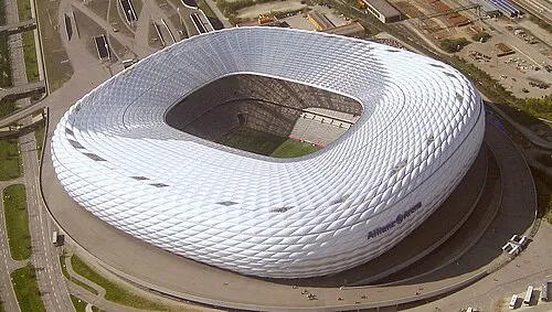 Allianz Arena München Landmark, Munich2.9 km W
-
Schwabinger Bach River, Bavaria1.8 km N
-
München-Freimann Concentration Camp (SS-Standortverwaltung) Historic site, Munich4 km SW
-
München-Freimann Concentration Camp (Bartolith Werke) Historic site, Munich4.6 km SW
-
Richtfunkturm Unterföhring Landmark, Munich4.2 km SW
-
Hochbunker, Heidemannstraße, München Landmark, Munich4.4 km SW
Sources & licences
Data last updated: