Mühlenbecker See
Located in Brandenburg, Germany Coordinates: 52°41′26″ N 13°23′44″ E
- Elevation
- 47 m
- above sea level
- Local time
- UTC+01:00
- Europe/Berlin · UTC+01:00
About Mühlenbecker See
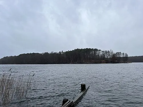
Mühlenbecker See is a lake. Location: Brandenburg, Germany. Elevation: 47 m.
In comparison
- 49 sights and natural places within 10 km Naturschutzgebiet Tegeler Fließtal, Summter See
Nearest towns and villages
-
Mühlenbecker Land Village, Landkreis Oberhavel3 km SW
-
Summt Village, Mühlenbecker Land1.7 km W
-
Birkenwerder Village, Landkreis Oberhavel6.2 km W
-
Buchenberg Neighbourhood, Mühlenbecker Land2.1 km W
-
Feldheim Neighbourhood, Mühlenbecker Land2.3 km SW
-
Buchhorst Neighbourhood, Mühlenbecker Land2.3 km S
Nearby attractions & nature
Everything nearby-
Naturschutzgebiet Tegeler Fließtal Natural site, Mühlenbecker Land1.1 km S
-
Summter See Lake, Brandenburg1.5 km W
-
Forst Schönwalde Natural site, Brandenburg2.8 km E
-
Petersberg Mountain, Wandlitz3.8 km S
-
Mühlenbecker Forst Natural site, Hohen Neuendorf3.7 km W
-
Basdorfer Heide Natural site, Brandenburg4.8 km NE
-
Off-Road Strecke Natural site, Wandlitz4.4 km NE
-
Gorinsee Lake, Brandenburg5.1 km E
More lakes, rivers and coasts in Germany
-
 Großer Werder Island, Brandenburg9.7 km NE
-
Lubowsee Lake, Brandenburg5.7 km N
-
Rahmer See Lake, Wandlitz6.5 km N
-
Kindelsee Lake, Brandenburg7.1 km SW
-
Sand See Lake, Brandenburg7.6 km W
-
Wandlitzer See Lake, Brandenburg8.5 km NE
Sources & licences
Data last updated: