Kerstlingerode
Located in Gleichen, Landkreis Göttingen Coordinates: 51°28′23″ N 10°06′20″ E
- Elevation
- 231 m
- above sea level
- Local time
- UTC+01:00
- Europe/Berlin · UTC+01:00
About Kerstlingerode
Kerstlingerode is a village. Location: Gleichen, Landkreis Göttingen. Elevation: 231 m.
Kerstlingerode is a village in the municipality (Gemeinde) Gleichen in the district Göttingen, Germany. It lies on L569 between Beienrode and Rittmarshausen, about ten kilometers south-east of Göttingen. The village of 245 residents (as of December 31, 2010) is primarily agricultural. There is one church and the largest school in the municipality. There is a volunteer fire department and a wind-instrument band. The village mayor is Sabine Lorch.
Read more on Wikipedia Text: Wikipedia contributors · CC BY-SA 4.0 · shortened
In comparison
- Nearest larger town: Gleichen, 3 km W
- 62 sights and natural places within 10 km Eichenberg, Klafterberg
Nearby attractions & nature
Everything nearby-
Eichenberg Mountain, Gleichen1.7 km SW
-
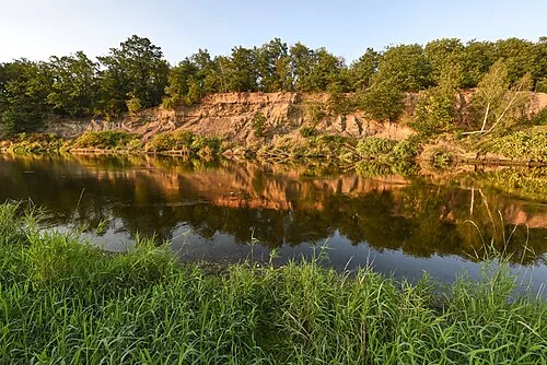 Rote Uferberg Mountain, Gleichen2.4 km E
-
Klafterberg Mountain, Gleichen2.4 km SE
-
Mühlenberg Mountain, Gleichen3.4 km NW
-
Silberberg Mountain, Gleichen4 km SE
-
Mausberg Mountain, Gleichen4.2 km S
Sources & licences
Data last updated: · 2 independent sources