Barther Oie
Located in Mecklenburg-Vorpommern, Germany Coordinates: 54°24′32″ N 12°43′40″ E
- Elevation
- -3 m
- above sea level
- Local time
- UTC+01:00
- Europe/Berlin · UTC+01:00
About Barther Oie
Barther Oie is an island. Location: Mecklenburg-Vorpommern, Germany.
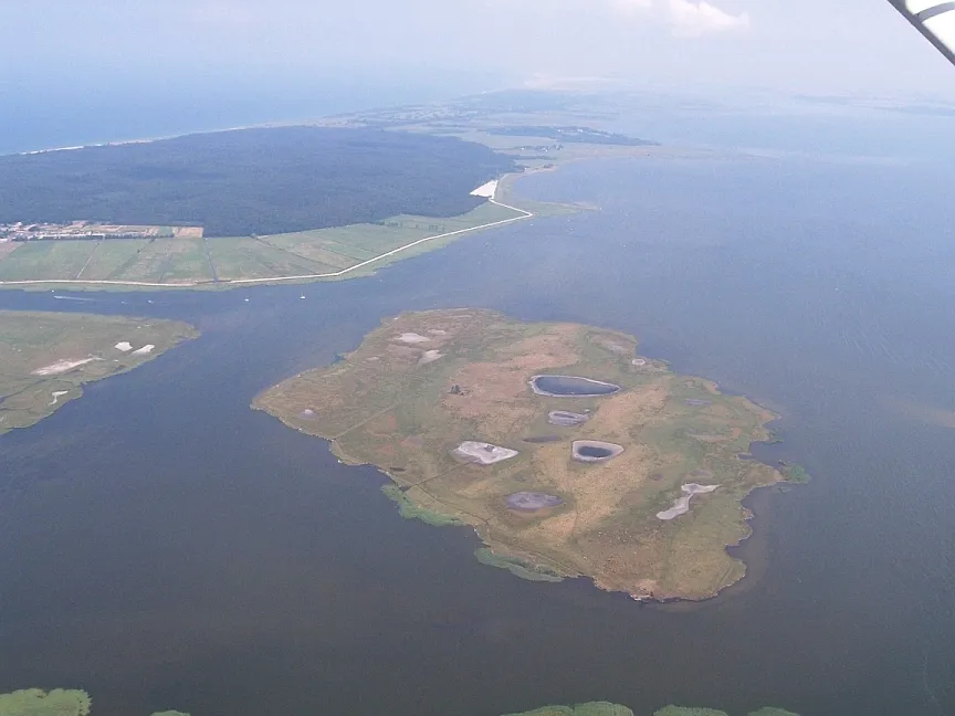
Barther Oie is an uninhabited island in the German federal state of Mecklenburg-Vorpommern and lies in the lagoon of Barther Bodden, between the town of Barth and the Baltic seaside resort of Zingst. The Baltic Sea island has an area of about 850 by 800 metres (2,790 ft × 2,620 ft) and rises, like its sister island of Kirr, only 1 metre (3 ft 3 in) above sea level. Today, the island is part of the West Pomeranian Lagoon Area National Park and is designated as a nature reserve.
Read more on Wikipedia Text: Wikipedia contributors · CC BY-SA 4.0 · shortened
At a glance
- Length
- 0.8 km
- Area
- 89 ha
Source: Wikidata
In comparison
- 35 sights and natural places within 10 km Barther Bodden, Fitt
Nearest towns and villages
-
Zingst Village, Landkreis Vorpommern-Rügen4 km NW
-
Zingst Village, Zingst3.9 km NW
-
Klein Kirr Village, Zingst1.3 km N
-
Pruchten Village, Landkreis Vorpommern-Rügen4.9 km SW
-
Barth Village, Landkreis Vorpommern-Rügen5.8 km S
-
Müggenburg Village, Zingst2.1 km NE
Nearby attractions & nature
Everything nearby-
Groß Kirr Island, Mecklenburg-Vorpommern2.4 km NW
-
Barther Bodden Lake, Mecklenburg-Vorpommern1.9 km SE
-
Gänsebrink Island, Mecklenburg-Vorpommern2.7 km N
-
Fitt Lake, Mecklenburg-Vorpommern2.3 km W
-
Straminke Natural site, Mecklenburg-Vorpommern3.1 km NE
-
Katharinen See Lake, Barth3.6 km S
-
Schmidtbülten Island, Mecklenburg-Vorpommern5.8 km W
-
Bülten Island, Pruchten4.3 km W
More lakes, rivers and coasts in Germany
-
Lychensee Lake, Mecklenburg-Vorpommern6.7 km NW
-
Hundetief Lake, Mecklenburg-Vorpommern6.7 km NW
-
Butterwiek Lake, Mecklenburg-Vorpommern6.7 km NW
-
Jäger Bülten Island, Mecklenburg-Vorpommern10 km W
-
 Großer Werder Island, Mecklenburg-Vorpommern14 km E
-
Bodstedter Bodden Lake, Mecklenburg-Vorpommern6.9 km W
Sources & licences
Data last updated: · 2 independent sources