Liebitz
Located in Mecklenburg-Vorpommern, Germany Coordinates: 54°23′58″ N 13°12′48″ E
- Elevation
- -1 m
- above sea level
- Local time
- UTC+01:00
- Europe/Berlin · UTC+01:00
About Liebitz
Liebitz is an island. Location: Mecklenburg-Vorpommern, Germany.
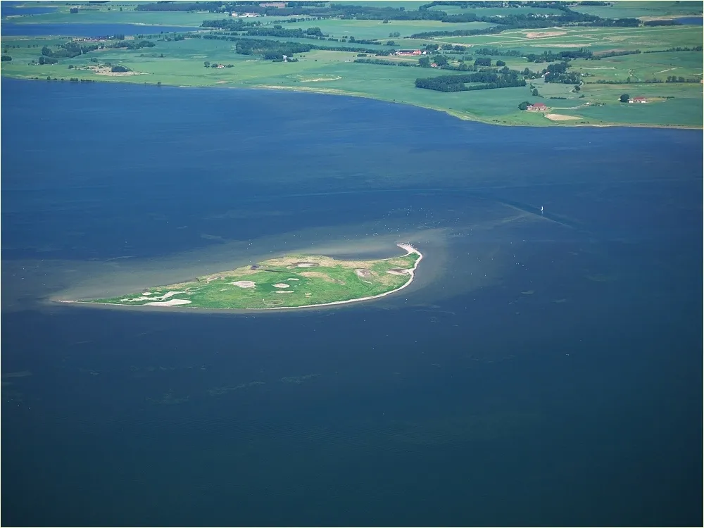
Liebitz (German pronunciation: [ˈliːbɪts]) is a German island in the lagoon of Kubitzer Bodden about 700 metres west of Germany's largest island, Rügen, in the state of Mecklenburg-Vorpommern. It belongs to the municipality of Dreschvitz. The island is about 1,000 × 700 metres across and has an area of about 64 ha. In the west of this low island, only a few metres high, is the island's Pleistocene core, which is increasingly being eroded by the water. In the east there are flat salt meadows.
Read more on Wikipedia Text: Wikipedia contributors · CC BY-SA 4.0 · shortened
At a glance
- Length
- 1 km
- Area
- 64 ha
Source: Wikidata
In comparison
- 30 sights and natural places within 10 km Kubitzer Bodden, Landower Wedde
Nearest towns and villages
Nearby attractions & nature
Everything nearby-
Kubitzer Bodden Lake, Mecklenburg-Vorpommern2.2 km W
-
Landower Wedde Lake, Mecklenburg-Vorpommern2.5 km E
-
Lieschow Natural site, Mecklenburg-Vorpommern4.6 km N
-
 Heuwiese Island, Mecklenburg-Vorpommern6.9 km NW
-
Grützberg Mountain, Gingst5.9 km NE
-
Sehrowbach River, Mecklenburg-Vorpommern3.7 km SE
-
 Ummanz Island, Mecklenburg-Vorpommern8.6 km N
-
Varbelvitzer Bodden Lake, Mecklenburg-Vorpommern6 km N
More lakes, rivers and coasts in Germany
-
 Gänsewerder Island, Mecklenburg-Vorpommern12 km NW
-
Insel Liebes Island, Mecklenburg-Vorpommern7 km N
-
Insel Wührens Island, Ummanz7.2 km N
-
Karowsee Lake, Samtens7.4 km SE
-
Urkevitz Island, Mecklenburg-Vorpommern7.4 km N
-
Cavelin Lake, Mecklenburg-Vorpommern7.7 km N
Sources & licences
Data last updated: · 2 independent sources