Eyllsche Kendel
Located in North Rhine-Westphalia, Germany Coordinates: 51°30′00″ N 6°31′00″ E
- Elevation
- 27 m
- above sea level
- Local time
- UTC+01:00
- Europe/Berlin · UTC+01:00
About Eyllsche Kendel
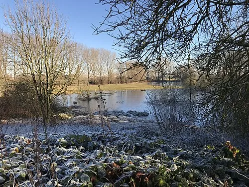
Eyllsche Kendel is a river. Location: North Rhine-Westphalia, Germany.
In comparison
- 39 sights and natural places within 10 km Kloster Kamp, Dachsberg
Nearest towns and villages
-
Kamp-Lintfort Village, Kreis Wesel1.2 km E
-
Kamp-Lintfort Town, Kamp-Lintfort2.1 km E
-
Kamper Berg Village, Kamp-Lintfort0.4 km N
-
Rheurdt Village, Kreis Kleve5.1 km SW
-
Kamperbrück Village, Kamp-Lintfort1.2 km NW
-
Neukirchen-Vluyn Village, Kreis Wesel6 km SE
Nearby attractions & nature
Everything nearby-
Dachsberg Mountain, Kamp-Lintfort1.1 km SW
-
Kloster Kamp Attraction, Kamp-Lintfort0.3 km N
-
Niersenberg Mountain, Kamp-Lintfort1.9 km N
-
Eyller Berg Mountain, Kamp-Lintfort1.9 km S
-
Plankendickskendel River, North Rhine-Westphalia3 km SE
-
Vluynbusch Natural site, North Rhine-Westphalia3.1 km S
-
Kaplanskuhlen Lake, North Rhine-Westphalia4 km SW
-
Rayer Berg Mountain, Neukirchen-Vluyn3.5 km S
More lakes, rivers and coasts in Germany
-
 Bislicher Insel Island, North Rhine-Westphalia16 km N
-
Haferbruchsee Lake, Rheinberg6 km NE
-
Haferbruchsgraben River, North Rhine-Westphalia6.1 km E
-
Büdericher Insel Island, North Rhine-Westphalia17 km NE
-
Saalhoffer Ley River, North Rhine-Westphalia6.2 km N
-
Nenneper Fleuth River, North Rhine-Westphalia7.3 km NW
Sources & licences
Data last updated: