Sülzetal
Located in Börde Rural District, Saxony-Anhalt Coordinates: 52°01′00″ N 11°33′00″ E
- Population
- 8,577
- 8.6K
- Elevation
- 79 m
- above sea level
- Local time
- UTC+01:00
- Europe/Berlin · UTC+01:00
- Places inside
- 13
- listed under Sülzetal
About Sülzetal
Sülzetal is a village. Location: Börde Rural District, Saxony-Anhalt. Population: 8,577. Elevation: 79 m.
In comparison
- No. 8 of 34 places in Börde Rural District by population
- Nearest larger town: Wanzleben-Börde, 10 km NW
- 22 sights and natural places within 10 km Heßberg, Bahrendorf, Dorfkirche Sankt Stephanus
- Listed here: Village: 9, Attraction: 2, Mountain: 2
Airports nearest to Sülzetal
- Leipzig/Halle Airport (LEJ) Schkeuditz 81 km
- Erfurt-Weimar Airport (ERF) Erfurt 123 km
- Hannover Airport (HAJ) Hannover 137 km
Straight-line distance; airports with scheduled flights only. Source: OurAirports (public domain).
Places in Sülzetal
13 places-
Altenweddingen Village
-
Altenweddingen, Dorfkirche St. Martin Attraction
-
Bahrendorf Village
-
Bahrendorf, Dorfkirche Sankt Stephanus Attraction
-
Buttenkrug Village
-
Dodendorf Village
-
Heßberg Mountain
-
Langenweddingen Village
-
Osterweddingen Village
-
Quellenhoch Mountain
-
Schwaneberg Village
-
Stemmern Village
-
Sülldorf Village
Nearby attractions & nature
Everything nearby-
Seerennengraben River, Saxony-Anhalt2.1 km N
-
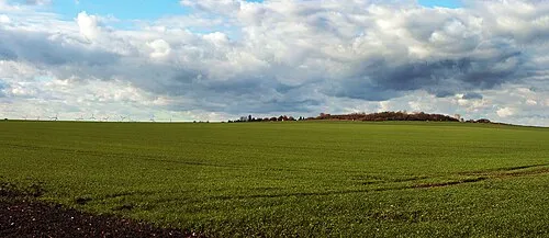 Henneberg Mountain, Wanzleben-Börde5.9 km W
-
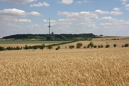 Frohser Berg Mountain, Schönebeck (Elbe)8.2 km E
-
Lausehoch Mountain, Borne6.5 km SE
-
Kreuzberg Mountain, Wolmirsleben7.8 km S
-
Wielberg Mountain, Bördeland8.2 km E
Sources & licences
Data last updated: