Der Hain
Located in Saxony-Anhalt, Germany Coordinates: 51°13′06″ N 11°36′39″ E
- Elevation
- 221 m
- above sea level
- Local time
- UTC+01:00
- Europe/Berlin · UTC+01:00
About Der Hain
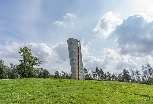
Der Hain is a natural site. Location: Saxony-Anhalt, Germany.
In comparison
- 25 sights and natural places within 10 km Steinbach, Gutschbach
Nearest towns and villages
-
Thalwinkel Village, Bad Bibra0.6 km N
-
Bad Bibra Village, Bad Bibra2.1 km SW
-
Bad Bibra Village, Burgenlandkreis2.8 km SW
-
Golzen Village, Bad Bibra2 km E
-
Laucha an der Unstrut Village, Burgenlandkreis5.1 km E
-
Bergwinkel Village, Bad Bibra1 km N
Nearby attractions & nature
Everything nearby-
Kaiser-Friedrichs-Höhe Mountain, Bad Bibra2.8 km SW
-
Steinbach River, Saxony-Anhalt1.5 km SW
-
Gutschbach River, Saxony-Anhalt1.5 km SW
-
Mermel Mountain, Laucha an der Unstrut3.9 km NE
-
Galgenberg Mountain, Laucha an der Unstrut5.2 km NE
-
Orlas Mountain, Bad Bibra5.2 km W
-
Haardt Mountain, Balgstädt5.5 km SE
-
Schimmelhöhe Mountain, An der Poststraße5.8 km S
More nature in Germany
-
Großer Mermel Mountain, Karsdorf6 km NE
-
Ennsberg Mountain, Laucha an der Unstrut6.2 km E
-
 Mittelberg Mountain, Querfurt9.6 km NW
-
Langer Berg Mountain, Gleina7.4 km E
-
Schafberg Mountain, Freyburg (Unstrut)7.7 km E
-
Der Bock Mountain, Querfurt8.4 km NW
Sources & licences
Data last updated: