Zittau
Located in Landkreis Görlitz, Saxony Coordinates: 50°54′28″ N 14°48′04″ E
- Population
- 25,286
- 25.3K
- Elevation
- 272 m
- above sea level
- Local time
- UTC+01:00
- Europe/Berlin · UTC+01:00
- Places inside
- 23
- listed under Zittau
About Zittau
Zittau is a village. Location: Landkreis Görlitz, Saxony. Population: 25,286. Elevation: 272 m.
Zittau (German: [ˈtsɪtaʊ] ; Upper Sorbian: Žitawa [ˈʒitawa] ; Lower Sorbian: Žytawa [ˈʒɨtawa]; Polish: Żytawa [ˈʐɨtava] ; Czech: Žitava; Upper Lusatian dialect: Sitte) is a city in the German state of Saxony, belonging to the district of Görlitz, Germany's easternmost district. Zittau is located in Upper Lusatia, the southern part of Lusatia, on the Mandau and Lusatian Neisse rivers, in the foreland of the Zittau Mountains.
Read more on Wikipedia Text: Wikipedia contributors · CC BY-SA 4.0 · shortened
At a glance
- Area
- 66.8 km²
Source: Wikidata
In comparison
- No. 2 of 53 places in Landkreis Görlitz by population
- Nearest larger town: Landkreis Görlitz, 29 km NE
- 51 sights and natural places within 10 km Zittau Concentration Camp, Steinberg
- Listed here: Village: 14, Mountain: 7, Historic site: 1, Town: 1
Places in Zittau
23 places-
Zittau Town25.3K
-
Hirschfelde Village4K
-
Schlegel Village1.1K
-
Buchberg Mountain
-
Burkersdorf Village
-
Dittelsdorf Village
-
Drausendorf Village
-
Eichgraben Village
-
Großer Berg Mountain
-
Hartau Village
-
Hutberg Mountain
-
Pethau Village
-
Romerei Village
-
Rosenthal Village
-
Sandberg Mountain
-
Schlegelberg Mountain
-
Schlegeler Feldhäuser Village
-
Steinberg Mountain
-
Straßberg Mountain
-
Viehbig Village
-
Wittgendorf Village
-
Wittgendorfer Feldhäuser Village
-
Zittau Concentration Camp Historic site
Nearby attractions & nature
Everything nearby-
Steinberg Mountain, Mittelherwigsdorf2.3 km NE
-
Grundbach River, Saxony3 km SW
-
Butterhübel Mountain, Olbersdorf4.7 km S
-
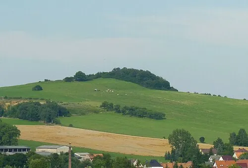 Hutberg Mountain, Oderwitz5.7 km NW
-
Schanzberg Mountain, Mittelherwigsdorf5.4 km N
-
Scheibeberg Mountain, Mittelherwigsdorf4.6 km W
Sources & licences
Data last updated: · 2 independent sources