Bad Lausick
Located in Landkreis Leipzig, Saxony Coordinates: 51°09′00″ N 12°38′00″ E
- Population
- 8,043
- 8K
- Elevation
- 159 m
- above sea level
- Local time
- UTC+01:00
- Europe/Berlin · UTC+01:00
- Places inside
- 18
- listed under Bad Lausick
About Bad Lausick
Bad Lausick is a village. Location: Landkreis Leipzig, Saxony. Population: 8,043. Elevation: 159 m.
Bad Lausick (German: [ˈbaːt ˈlaʊzɪk] ) is a town in the Leipzig district, in Saxony, Germany. It is situated 12 km southwest of Grimma, and 29 km southeast of Leipzig.
Read more on Wikipedia Text: Wikipedia contributors · CC BY-SA 4.0 · shortened
At a glance
- Area
- 70 km²
Source: Wikidata
In comparison
- No. 12 of 29 places in Landkreis Leipzig by population
- Nearest larger town: Bad Lausick, 1 km SE
- 32 sights and natural places within 10 km Viertelsberg, Geldberg
- Listed here: Village: 13, Mountain: 4, Town: 1
Places in Bad Lausick
18 places-
Bad Lausick Town9K
-
Ballendorf Village
-
Ballendorf TP Mountain
-
Beucha Village
-
Buchheim Village
-
Ebersbach Village
-
Etzoldshain Village
-
Geldberg Mountain
-
Glasten Village
-
Kleinbeucha Village
-
Köllsdorf Village
-
Lauterbach Village
-
Mark Village
-
Schiefer Berg Mountain
-
Steinbach Village
-
Stockheim Village
-
Thierbaum Village
-
Viertelsberg Mountain
Nearby attractions & nature
Everything nearby-
Heidelberg Mountain, Frohburg3.6 km SW
-
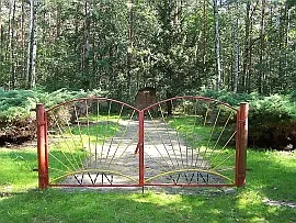 Flößberg Concentration Camp Historic site, Frohburg4.3 km SW
-
Unteres Schildholz Natural site, Saxony3 km SW
-
Oberes Schildholz Natural site, Saxony3 km SW
-
Weinberg Mountain, Frohburg4.7 km SW
-
Lausicker Berg Mountain, Grimma4.5 km NE
Sources & licences
Data last updated: · 2 independent sources