Klingenthal
Located in Vogtlandkreis, Saxony Coordinates: 50°22′00″ N 12°28′00″ E
- Population
- 7,289
- 7.3K
- Elevation
- 583 m
- above sea level
- Local time
- UTC+01:00
- Europe/Berlin · UTC+01:00
- Places inside
- 30
- listed under Klingenthal
About Klingenthal
Klingenthal is a village. Location: Vogtlandkreis, Saxony. Population: 7,289. Elevation: 583 m.
Klingenthal (German pronunciation: [ˈklɪŋənˌtaːl] ) is a town in the Vogtland region, in Saxony, south-eastern Germany.
Read more on Wikipedia Text: Wikipedia contributors · CC BY-SA 4.0 · shortened
At a glance
- Area
- 50.4 km²
Source: Wikidata
In comparison
- No. 5 of 35 places in Vogtlandkreis by population
- Nearest larger town: Klingenthal, 1 km S
- 50 sights and natural places within 10 km Brunndöbra-Bach, Hansel-Berg
- Listed here: Village: 17, Mountain: 9, Attraction: 1, Landmark: 1
Places in Klingenthal
30 places-
Klingenthal Town9.1K
-
Zwota Village1.5K
-
Aschberg Village
-
Brunndöbra Village
-
Dreihöfe Village
-
Goldberg Mountain
-
Gösselhäuser Village
-
Hansel-Berg Mountain
-
Herrenberg Mountain
-
Hraniční vrch [Kraslice-Hraničná] Mountain
-
Kiel Mountain
-
Kriegberg Village
-
Lämpelberg Village
-
Mittelberg Village
-
Mühlleithen Village
-
Obersachsenberg Village
-
Sachsenberg-Georgenthal Village
-
Scheibenberg Mountain
-
Schiefer Berg Mountain
-
Schlosserberg Village
-
Schwarzberg Mountain
-
Sommerberg Village
-
Steindöbra Village
-
Unterklingenthal Village
-
Waldgutsberg Village
-
Winselburg Village
-
Wolfsberg Mountain
-
Zechenbach Neighbourhood
-
Zwota, Kirche Attraction
Nearby attractions & nature
Everything nearby-
Brunndöbra-Bach River, Saxony1.9 km S
-
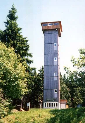 Aschberg Mountain, Germany3.9 km NE
-
Forst Erlbach Natural site, Saxony3 km SW
-
Döhlerwald Natural site, Saxony3 km SW
-
Zwotabach River, Saxony2.9 km SW
-
Jelen Mountain, Stříbrná5.5 km NE
Sources & licences
Data last updated: · 2 independent sources