Stockelsdorf
Local name: Stockelsdörp
Located in Kreis Ostholstein, Schleswig-Holstein Coordinates: 53°53′26″ N 10°37′33″ E
- Population
- 16,289
- 16.3K
- Elevation
- 17 m
- above sea level
- Local time
- UTC+01:00
- Europe/Berlin · UTC+01:00
- Places inside
- 18
- listed under Stockelsdorf
About Stockelsdorf
Stockelsdorf is a village. Location: Kreis Ostholstein, Schleswig-Holstein. Population: 16,289. Elevation: 17 m.
Stockelsdorf is a municipality in the district of Ostholstein, in Schleswig-Holstein, Germany. It is situated directly northwest of Lübeck and forms an agglomeration with the easterly town of Bad Schwartau. The municipality contains the villages of Arfrade, Curau, Dissau, Eckhorst, Horsdorf, Klein Parin, Krumbeck, Malkendorf, Obernwohlde and Pohnsdorf. By measure of population Stockelsdorf is the second largest municipality without town status in Schleswig-Holstein.
Read more on Wikipedia Text: Wikipedia contributors · CC BY-SA 4.0 · shortened
At a glance
- Area
- 56.7 km²
Source: Wikidata
In comparison
- No. 3 of 36 places in Kreis Ostholstein by population
- Nearest larger town: Stockelsdorf, 1 km E
- 68 sights and natural places within 10 km Fernmeldeturm Stockelsdorf, Barger Au
- Listed here: Village: 13, Neighbourhood: 2, Landmark: 1, River: 1
Places in Stockelsdorf
18 places-
Stockelsdorf Town16.6K
-
Arfrade Village
-
Bareneck Neighbourhood
-
Barger Au River
-
Clever Landwehr Village
-
Curau Village
-
Dissau Village
-
Eckhorst Village
-
Fernmeldeturm Stockelsdorf Landmark
-
Horsdorf Village
-
Klein Parin Village
-
Krumbeck Village
-
Lilienkuhl Neighbourhood
-
Lohe Village
-
Malkendorf Village
-
Mariental Village
-
Obernwohlde Village
-
Pohnsdorf Village
Nearby attractions & nature
Everything nearby-
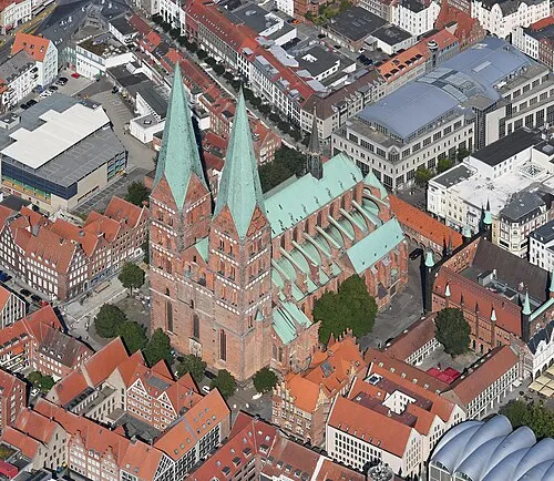 St. Mary's Church Attraction, Lübeck, Hansestadt4.6 km SE
-
Lohmühle Landmark, Lübeck, Hansestadt3 km E
-
Wüstenei Natural site, Schleswig-Holstein3.4 km W
-
Rocksholz Natural site, Bad Schwartau3.6 km NE
-
Herrenholz Natural site, Lübeck, Hansestadt4 km S
-
Teerhofsinsel Island, Schleswig-Holstein5.1 km E
Sources & licences
Data last updated: · 2 independent sources