Amt Wachsenburg
Located in Ilm-Kreis, Thuringia Coordinates: 50°51′57″ N 10°54′55″ E
- Population
- 8,041
- 8K
- Elevation
- 294 m
- above sea level
- Local time
- UTC+01:00
- Europe/Berlin · UTC+01:00
- Places inside
- 18
- listed under Amt Wachsenburg
About Amt Wachsenburg
Amt Wachsenburg is a village. Location: Ilm-Kreis, Thuringia. Population: 8,041. Elevation: 294 m.
In comparison
- No. 5 of 16 places in Ilm-Kreis by population
- Nearest larger town: Arnstadt, 4 km SE
- 43 sights and natural places within 10 km Zettelberg, Wein-Berg
- Listed here: Village: 12, Neighbourhood: 3, Mountain: 2, Historic site: 1
Places in Amt Wachsenburg
18 places-
Ichtershausen Neighbourhood3.9K
-
Kirchheim Neighbourhood1.2K
-
Bittstädt Village583
-
Rockhausen Neighbourhood277
-
Arnshall Village
-
Bechstedt-Wagd Village
-
Eischleben Village
-
Haarhausen Village
-
Holzhausen Village
-
Rehestädt Village
-
Röhrensee Village
-
Sülzenbrücken Village
-
Thörey Village
-
Veste Wachsenburg Historic site
-
Wachsenburg Mountain
-
Wachsenburg Village
-
Werningsleben Village
-
Zettelberg Mountain
Nearby attractions & nature
Everything nearby-
Kalkberg Mountain, Arnstadt1.8 km S
-
Weinberg Mountain, Arnstadt1.9 km S
-
Wein-Berg Mountain, Arnstadt1.8 km S
-
Pfennigsberg Mountain, Arnstadt3.2 km S
-
Längel Mountain, Drei Gleichen3.4 km W
-
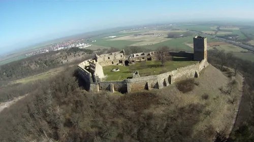 Burg Gleichen Historic site, Drei Gleichen5.6 km W
Sources & licences
Data last updated: