Kreisfreie Stadt Erfurt
Local name: Erfurt
Located in Thuringia, Germany Coordinates: 50°58′58″ N 11°02′33″ E
- Population
- 218,793
- 218.8K
- Elevation
- 194 m
- above sea level
- Local time
- UTC+01:00
- Europe/Berlin · UTC+01:00
- Places inside
- 1
- listed under Kreisfreie Stadt Erfurt
About Kreisfreie Stadt Erfurt
Kreisfreie Stadt Erfurt is a municipality. Location: Thuringia, Germany. Population: 218,793. Elevation: 194 m.
Erfurt (German pronunciation: [ˈɛʁfʊʁt] ) is the capital and largest city of the Central German state of Thuringia, with a population of around 216,000. It lies in the wide valley of the River Gera, in the southern part of the Thuringian Basin, north of the Thuringian Forest, and in the middle of a line of the six largest Thuringian cities (Thüringer Städtekette), stretching from Eisenach in the west, via Gotha, Erfurt, Weimar and Jena, to Gera in the east.
Read more on Wikipedia Text: Wikipedia contributors · CC BY-SA 4.0 · shortened
At a glance
- Built
- 742
- Area
- 270 km²
Source: Wikidata
In comparison
- Most populous of 23 places in Thuringia
- 39 sights and natural places within 10 km Erfurt Augustinerkirche, Erfurt Angermuseum
Places in Kreisfreie Stadt Erfurt
1 place-
Erfurt Village218.8K
Nearby attractions & nature
Everything nearby-
Steigerwald Natural site, Thuringia4.2 km SW
-
Willroder Forst Natural site, Thuringia7 km SE
-
Silberberg Mountain, Kleinmölsen7.7 km NE
-
Klosterholz Natural site, Thuringia8.2 km SE
-
Weißbach River, Thuringia7.6 km NW
-
Linderbach River, Thuringia8.1 km NE
-
Mühlengraben River, Thuringia8.4 km NE
-
Apfelstädt River, Thuringia8.8 km SW
Other cities and towns in Thuringia
-
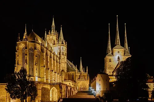 Erfurt City, Erfurt0.8 km SW
-
Landkreis Gotha Municipality, Thuringia25 km W
-
Landkreis Sömmerda Municipality, Thuringia23 km NE
-
Kreisfreie Stadt Weimar Municipality, Thuringia21 km E
-
Weimarer Land Municipality, Thuringia26 km E
-
Ilm-Kreis Municipality, Thuringia29 km S
Sources & licences
Data last updated: · 2 independent sources