Korberoth
Located in Frankenblick, Landkreis Sonneberg Coordinates: 50°21′33″ N 11°04′39″ E
- Elevation
- 478 m
- above sea level
- Local time
- UTC+01:00
- Europe/Berlin · UTC+01:00
About Korberoth
Korberoth is a village. Location: Frankenblick, Landkreis Sonneberg. Elevation: 478 m.
Korberoth was a small village near Frankenblick, in the Sonneberg district of Thuringia, Germany. The village was first documented in 1334 as Cubenrode. In 1910, the village had a population of 21. The village was located near the Inner German border and was thus, for exaggerated border security measures, completely destroyed in 1984 after the residents were forcibly relocated in 1970.
Read more on Wikipedia Text: Wikipedia contributors · CC BY-SA 4.0 · shortened
At a glance
- Heritage designation
- Kulturdenkmal
Source: Wikidata
In comparison
- Nearest larger town: Frankenblick, 2 km N
- 99 sights and natural places within 10 km Stammberg, Müß
Nearby attractions & nature
Everything nearby-
Taubelsberg Mountain, Frankenblick3.1 km NE
-
Görzenberg Mountain, Frankenblick3.1 km NE
-
Fichtacher Berg Mountain, Frankenblick3.3 km N
-
Stammberg Mountain, Frankenblick2.8 km W
-
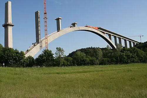 Talbrücke Froschgrundsee Landmark, Rödental3.9 km W
-
Isaak Mountain, Frankenblick3.5 km E
Sources & licences
Data last updated: · 2 independent sources