Pacheia Ammos
Local name: Παχεία Άμμος
Located in Ierapetra, Lasithi Coordinates: 35°06′32″ N 25°48′33″ E
- Population
- 827
- 827
- Elevation
- 0 m
- above sea level
- Local time
- UTC+02:00
- Europe/Athens · UTC+02:00
About Pacheia Ammos
Pacheia Ammos is a village. Location: Ierapetra, Lasithi. Population: 827. Elevation: 0 m.
Pacheia Ammos (Greek: Παχειά Άμμος, also Pachiá Ámmos) is a village in the municipality of Ierapetra on the island of Crete in Greece. It is located on the north coast of the island, 15 km to the north of the city of Ierapetra, at the fork in the road that leads to Heraklion in the west and Sitia in the east.
Read more on Wikipedia Text: Wikipedia contributors · CC BY-SA 4.0 · shortened
In comparison
- No. 8 of 86 places in Ierapetra by population
- Nearest larger town: Kato Chorio, 7 km S
Nearby attractions & nature
Everything nearby-
Kalamokanias beach Beach, Ierapetra17 km SE
-
Lagoufa beach Beach, Ierapetra18 km SE
-
Chani beach Beach, Ierapetra17 km SE
-
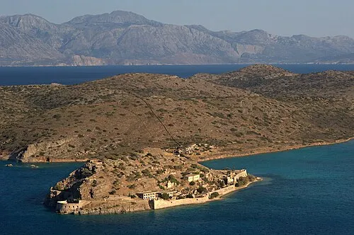 Spinalonga Island, Lasithi22 km N
-
Limanaki Beach Beach, Lasithi17 km SE
-
Kakó Farángi Natural site, Crete21 km E
Sources & licences
Data last updated: · 2 independent sources