Megalonísi
Local name: Μεγαλονήσι Σιγρίου
Located in Lesbos, North Aegean Coordinates: 39°12′55″ N 25°50′10″ E
- Elevation
- 38 m
- above sea level
- Local time
- UTC+02:00
- Europe/Athens · UTC+02:00
About Megalonísi
Megalonísi is an island. Location: Lesbos, North Aegean.
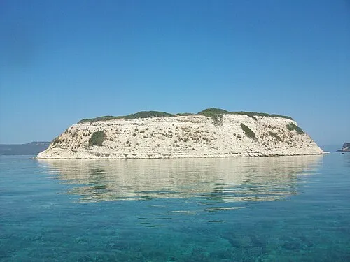
Megalonisi (Greek: Μεγαλονήσι), also Nisiopi (Greek: Νησιώπη), is a long island near the west coast of the island Lesbos, North Aegean, Greece. It is situated in front of Sigri's harbour, and stretches across the mouth of the bay and acts as a buffer to the prevailing winds. In the middle stands Megalonisi Lighthouse to help ships navigate in the rough east Aegean Sea.
Read more on Wikipedia Text: Wikipedia contributors · CC BY-SA 4.0 · shortened
At a glance
- Length
- 2.6 km
- Area
- 95 ha
Source: Wikidata
In comparison
- 2 sights and natural places within 10 km Skordonisi, Nisída Kavaloúros
Nearest towns and villages
-
Sigri Village, Lesbos1.5 km E
-
Lesbos Municipality, Lesbos15 km E
-
Eresós Village, Lesbos9.9 km SE
-
Antissa Village, Lesbos13 km E
-
Skála Eresoú Village, Lesbos12 km SE
-
AntissaTerpandros Windfarm Neighbourhood, Lesbos12 km E
Nearby attractions & nature
Everything nearby-
Nisída Kavaloúros Island, Lesbos2.1 km SW
-
Skordonisi Island, Lesbos2.1 km SE
More lakes, rivers and coasts in Greece
-
Nisída Garmpiás Island, Lesbos26 km SE
-
Ágios Georgios Island, Lesbos26 km SE
-
 Nisída Tsoukalás Island, Lesbos52 km E
-
 Nisída Barmpaliás Island, Lesbos53 km E
-
Nisída Kydonás Island, Lesbos53 km E
-
Nisída Monópetra Island, Lesbos49 km E
Sources & licences
Data last updated: · 2 independent sources