Agios Konstantinos
Local name: Άγιος Κωνσταντίνος
Located in Samos, Samos Prefecture Coordinates: 37°48′23″ N 26°49′11″ E
- Population
- 368
- 368
- Elevation
- 4 m
- above sea level
- Local time
- UTC+02:00
- Europe/Athens · UTC+02:00
About Agios Konstantinos
Agios Konstantinos is a village. Location: Samos, Samos Prefecture. Population: 368. Elevation: 4 m.
Agios Konstantinos is a coastal village on the northern shores of the Greek island Samos between the island’s two major towns Karlovasi west 10 km by road and Vathy east 20 km by road. The village faces the waters of the Aegean Sea. Stretched behind a narrow pebble beach and a protective stone wall Agios Konstantinos ascends into a patch work of stepped garden plots and forest intermittent by agricultural canals that ultimately source from natural streams further up the mountain.
Read more on Wikipedia Text: Wikipedia contributors · CC BY-SA 4.0 · shortened
In comparison
- No. 18 of 110 places in Samos by population
- Nearest larger town: Vourliotes, 3 km SE
Nearby attractions & nature
Everything nearby-
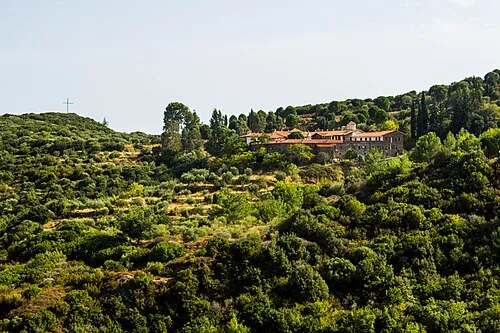 Moní Megális Panagías Attraction, Samos12 km S
-
Vrakonisis Vareludi Island, Samos Prefecture21 km SE
-
Nisída Kátergon Island, Samos25 km SW
-
Bayrak Adası Island, Aydın Province22 km SE
-
Theopori Island Island, Aydın Province24 km SE
-
Su Adası Island, Aydın Province24 km SE
Sources & licences
Data last updated: · 2 independent sources