Potamiá
Local name: Ποταμιά
Located in Megalopoli, Arcadia Coordinates: 37°17′50″ N 22°08′37″ E
- Population
- 51
- 51
- Elevation
- 456 m
- above sea level
- Local time
- UTC+02:00
- Europe/Athens · UTC+02:00
About Potamiá
Potamiá is a village. Location: Megalopoli, Arcadia. Population: 51. Elevation: 456 m.
Potamia (Greek: Ποταμιά meaning rivers) is a village in the municipal unit of Falaisia, Arcadia, Greece. It is on the right bank of a tributary of the river Alfeios, 2 km (1.2 mi) east of Ellinitsa, 3 km (1.9 mi) south of Leontari, 3 km (1.9 mi) northwest of Falaisia and 12 km (7.5 mi) south of Megalopoli. Every year in August the Parrasia folklore festival is organised in Potamia.
Read more on Wikipedia Text: Wikipedia contributors · CC BY-SA 4.0 · shortened
In comparison
- No. 30 of 65 places in Megalopoli by population
- Nearest larger town: Kalývia, 2 km N
Nearby attractions & nature
Everything nearby-
Moni Ambelaki Attraction, Megalopoli7.3 km SE
-
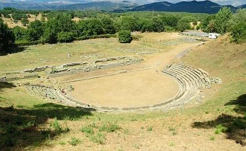 Ancient Theater of Megalopolis Historic site, Megalopoli13 km N
-
Ierá Moní Agíou Nikoláou Kaltezón Attraction, Tripoli14 km E
-
Moni Gardikiou Attraction, Kalamata23 km S
-
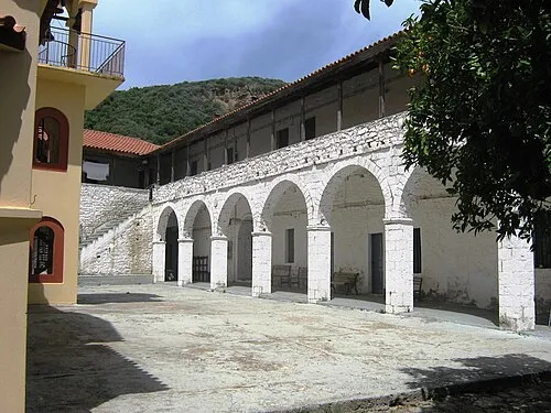 Moni Voulkanou Attraction, Messene23 km SW
Sources & licences
Data last updated: · 2 independent sources