Papadates
Local name: Παππαδάτες
Located in Agrinio, Aitoloakarnania Coordinates: 38°31′41″ N 21°27′01″ E
- Population
- 824
- 824
- Elevation
- 76 m
- above sea level
- Local time
- UTC+02:00
- Europe/Athens · UTC+02:00
About Papadates
Papadates is a village. Location: Agrinio, Aitoloakarnania. Population: 824. Elevation: 76 m.
Papadates (Greek: Παπαδάτες or Παππαδάτες) is a village in the regional unit of Aetolia-Acarnania. Situated in the region of West Greece, since 2011, it is part of the municipality of Agrinio. Papadates is located 12 km from the city of Agrinio, on the foothills of Arakynthos mountain and is one of the villages surrounding Lake Trichonida, the biggest Greek natural lake. It borders with the villages of Zevgaraki to the west and Mataranga to the east. It was the capital of the former municipality of Arakynthos.
Read more on Wikipedia Text: Wikipedia contributors · CC BY-SA 4.0 · shortened
In comparison
- No. 16 of 165 places in Agrinio by population
- Nearest larger town: Mataragka, 2 km E
Nearby attractions & nature
Everything nearby-
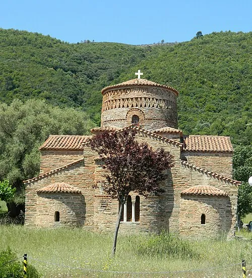 Panagia Panaxiotissa Attraction, Nafpaktia21 km SE
-
Zagarides Island, Missolonghi23 km SW
-
Paliomana Island, Aitoloakarnania18 km S
-
Nisída Askós Island, West Greece21 km SW
-
Nisída Megálo Bourmpoúli Island, West Greece24 km SW
-
Nisída Vasilikó Island, West Greece22 km S
Sources & licences
Data last updated: · 2 independent sources