Vrochítsa
Local name: Βροχίτσα
Located in Pyrgos, Ilia Prefecture Coordinates: 37°44′19″ N 21°26′52″ E
- Population
- 457
- 457
- Elevation
- 85 m
- above sea level
- Local time
- UTC+02:00
- Europe/Athens · UTC+02:00
About Vrochítsa
Vrochítsa is a village. Location: Pyrgos, Ilia Prefecture. Population: 457. Elevation: 85 m.
Vrochitsa (Greek: Βροχίτσα) is a settlement in the municipal unit of Iardanos, Greece. It is situated in a valley surrounded by low hills, at 80 m elevation. It is 2 km southwest of Elaionas, 2 km east of Fonaitika, 4 km east of Vounargo and 7 km north of Pyrgos. There is an elementary school, a church and a square.
Read more on Wikipedia Text: Wikipedia contributors · CC BY-SA 4.0 · shortened
In comparison
- No. 18 of 38 places in Pyrgos by population
- Nearest larger town: Prásino, 3 km SW
Airports nearest to Vrochítsa
- Patras Araxos Agamemnon Airport (GPA) Patras 46 km
- Zakynthos International Airport "Dionysios Solomos" (ZTH) Zakynthos 50 km
- Kalamata Airport (KLX) Kalamata 90 km
Straight-line distance; airports with scheduled flights only. Source: OurAirports (public domain).
Nearby attractions & nature
Everything nearby-
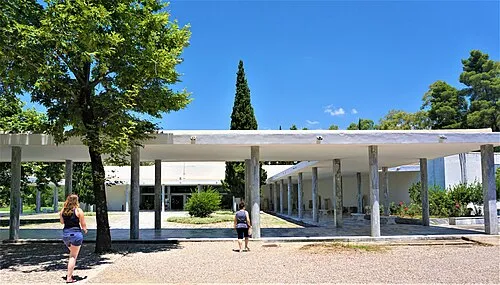 Archaeological Museum of Olympia Museum, Olympia19 km SE
-
Moní Agíou Ioánni Attraction, Olympia14 km SE
-
Nisída Tigáni Island, West Greece16 km SW
Sources & licences
Data last updated: · 2 independent sources