Alpokalja
Located in Hungary Coordinates: 47°22′00″ N 16°32′00″ E
- Elevation
- 298 m
- above sea level
- Local time
- UTC+01:00
- Europe/Budapest · UTC+01:00
About Alpokalja
Alpokalja is a mountain. Location: Hungary. Elevation: 298 m.
Alpokalja (English "feet of the Alps") is a mountainous region in western Hungary. Its highest point is Írott-kő at 882 metres above sea level. Although there are several lower mountains, the majority of the territory is hilly. Fir forests are characteristic to the region. Alpokalja contains two major but not very extensive mountain ranges: the Kőszeg Mountains and the Sopron Mountains. The Vas Hills and Balfi Hills are also considered part of the territory.
Read more on Wikipedia Text: Wikipedia contributors · CC BY-SA 4.0 · shortened
At a glance
- Area
- 851 km²
Source: Wikidata
In comparison
- No. 39 of 99 mountains in Hungary by elevation
- 6 sights and natural places within 10 km Kőszeg Ghetto, Kohlrücken
Nearest towns and villages
-
Kőszeg City, Vas County2.6 km N
-
Rattersdorf Village, Mannersdorf an der Rabnitz5.3 km NW
-
Mannersdorf an der Rabnitz Municipality, Oberpullendorf District6.5 km N
-
Liebing Village, Mannersdorf an der Rabnitz6 km NW
-
Klostermarienberg Village, Mannersdorf an der Rabnitz6.5 km N
-
Mannersdorf an der Rabnitz Village, Mannersdorf an der Rabnitz6.9 km N
Nearby attractions & nature
Everything nearby-
Kőszeg Ghetto Historic site, Vas County2.2 km NE
-
Günser Gebirge Mountain, Austria10 km W
-
Kohlrücken Mountain, Rechnitz7.4 km SW
-
Pinka River, Austria9.6 km SW
-
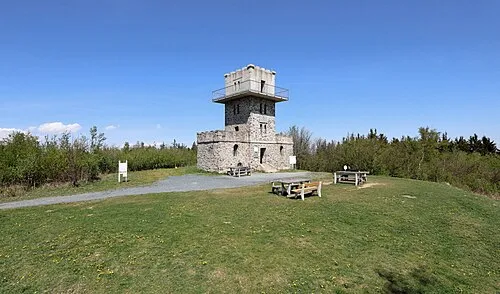 Írott-kő Mountain, Rechnitz7.7 km W
-
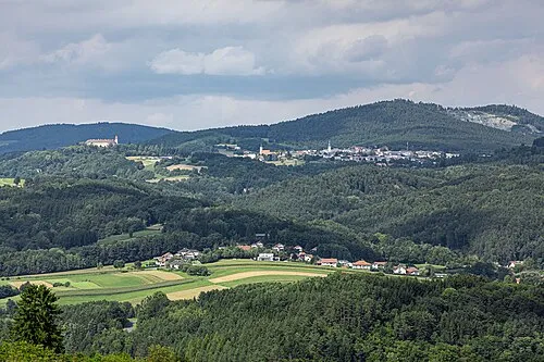 Bernsteiner Gebirge Mountain, Austria22 km W
-
Swickl Berg Mountain, Mannersdorf an der Rabnitz9.7 km NW
-
Zöbernbach River, Austria14 km NW
Sources & licences
Data last updated: · 2 independent sources