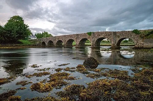
Dooreel Bridge
Located in County Mayo, Connacht Coordinates: 54°01′15″ N 9°51′43″ W
- Local time
- UTC+00:00
- Europe/Dublin · UTC+00:00
- Elevation
- 6 m
- above sea level
About Dooreel Bridge
Dooreel Bridge is a landmark. Location: County Mayo, Connacht.
In comparison
- 38 sights and natural places within 10 km Tallagh Bridge, Dooreel Creek
Airports nearest to Dooreel Bridge
- Ireland West Airport Knock (NOC) Charlestown 70 km
- Donegal Airport (CFN) Donegal 151 km
- Shannon Airport (SNN) Shannon 159 km
Straight-line distance; airports with scheduled flights only. Source: OurAirports (public domain).
Nearby attractions & nature
Everything nearby-
Tallagh Bridge Landmark, County Mayo0.7 km NE
-
Gubbiacorraun Natural site, County Mayo2 km W
-
Lough Creive Lake, County Mayo1.3 km NW
-
Inishaghod Island, County Mayo2.1 km SW
-
Illanamona Islands Island, County Mayo1.9 km SW
-
Creggan Bridge Landmark, County Mayo3.2 km N
-
Dooreel Creek River, County Mayo1.2 km SW
-
Glassillan Island, County Mayo3 km S
Nearest towns and villages
More sights in County Mayo
-
Srahnamanragh Bridge Landmark, County Mayo5.5 km N
-
Munhin Bridge Landmark, County Mayo17 km N
-
Mweelin Mast Landmark, County Mayo13 km SW
-
Glencastle Bridge Landmark, County Mayo18 km N
-
 Burrishoole Bridge Landmark, County Mayo23 km SE
-
Rosturk Castle Historic site, County Mayo17 km SE
Sources & licences
Data last updated: