Rathcoffey
Located in County Kildare, Leinster Coordinates: 53°20′08″ N 6°41′33″ W
- Population
- 271
- 271
- Elevation
- 76 m
- above sea level
- Local time
- UTC+00:00
- Europe/Dublin · UTC+00:00
About Rathcoffey
Rathcoffey is a village. Location: County Kildare, Leinster. Population: 271. Elevation: 76 m.
Rathcoffey (Irish: Ráth Chofaigh, meaning 'Cofaigh's ringfort') is a village in County Kildare, Ireland, around 30 km west of Dublin city centre. It had a population of 271 as of 2016 census. The village church, Rathcoffey Church, is part of the Clane & Rathcoffey Parish, and was built in 1710. Rathcoffey National School, a co-educational Catholic primary school, is the only educational institution in the village. Rathcoffey GAA is a Gaelic Athletic Association (GAA) club based in Rathcoffey.
Read more on Wikipedia Text: Wikipedia contributors · CC BY-SA 4.0 · shortened
In comparison
- No. 48 of 53 places in County Kildare by population
- Nearest larger town: Clane, 5 km S
- 14 sights and natural places within 10 km Clonshanbo River, Baltracey River
Nearby attractions & nature
Everything nearby-
Clonshanbo River River, County Kildare1.9 km N
-
Baltracey River River, County Kildare3.3 km NE
-
Donadea Castle Historic site, County Kildare3.6 km W
-
Donadea Forest Park Natural site, County Kildare3.6 km W
-
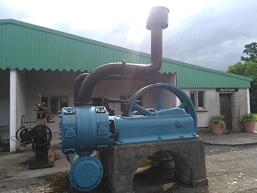 The Steam Museum Museum, County Kildare6.8 km SE
-
Morell River River, County Kildare6.4 km SE
Sources & licences
Data last updated: · 2 independent sources