Slieveacurry
Located in County Clare, Munster Coordinates: 52°51′38″ N 9°18′15″ W
- Elevation
- 255 m
- above sea level
- Local time
- UTC+00:00
- Europe/Dublin · UTC+00:00
About Slieveacurry
Slieveacurry is a mountain. Location: County Clare, Munster. Elevation: 255 m.
In comparison
- No. 1331 of 2106 mountains in Ireland by elevation
- 20 sights and natural places within 10 km Lough Keagh, Slievenalicka
Nearest towns and villages
-
Illaunbaun Village, County Clare1 km NW
-
Cloghannmore Village, County Clare2.4 km W
-
Fahanlunaghta Bridge Village, County Clare2.5 km NE
-
Milltown Malbay Village, County Clare6.4 km W
-
White’s Bridge Village, County Clare3 km N
-
Ballynew Bridge Village, County Clare3.3 km W
Nearby attractions & nature
Everything nearby-
Slievenalicka Mountain, County Clare2.7 km NW
-
Lough Keagh Lake, County Clare2.4 km NW
-
Knockabullaunduff Mountain, County Clare3.5 km NW
-
Slievecallan Mountain, County Clare3.1 km SE
-
Ailtbrack Lough Lake, County Clare4 km NW
-
Lough Boolynagreana Lake, County Clare4 km SE
-
Mooghna Lough Lake, County Clare5.3 km N
-
Lough Akit Lake, County Clare5.4 km E
More nature in Ireland
-
Slievebeg Mountain, County Clare12 km NE
-
Ben Dash Mountain, County Clare12 km SE
-
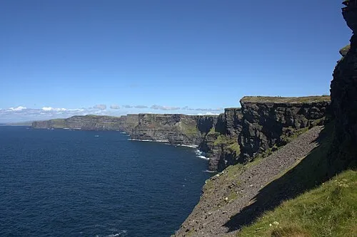 Cliffs of Moher Natural site, County Clare14 km NW
-
Knockalunkard Mountain, County Clare14 km NE
-
Knocknalarabana Mountain, County Clare15 km N
-
Clifden Hill Mountain, County Clare16 km NE
Sources & licences
Data last updated: · 2 independent sources