Croughaun Hill
Located in Waterford, Munster Coordinates: 52°15′01″ N 7°26′46″ W
- Elevation
- 391 m
- above sea level
- Local time
- UTC+00:00
- Europe/Dublin · UTC+00:00
About Croughaun Hill
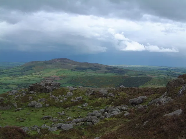
Croughaun Hill is a mountain. Location: Waterford, Munster. Elevation: 391 m.
Croughaun Hill (Irish: Cruachán Paorach or Cruachán) is a hill in north County Waterford, Ireland. It is a largely solitary hill to the east of the Comeragh Mountains.
Read more on Wikipedia Text: Wikipedia contributors · CC BY-SA 4.0 · shortened
In comparison
- No. 827 of 2106 mountains in Ireland by elevation
- 16 sights and natural places within 10 km Coumshingaun Lough, Knockaunapeebra
Nearest towns and villages
-
Kilmacthomas Village, Waterford5.2 km S
-
Clonea Village, Waterford3.2 km N
-
Fews Village, Waterford3.2 km S
-
Ballydurn Cross Roads Village, Waterford3.3 km E
-
Glennaphuca Cross Roads Village, Waterford3.9 km NE
-
Robertstown Village, Waterford4.4 km E
Nearby attractions & nature
Everything nearby-
Knockaunapeebra Mountain, Waterford6.8 km W
-
Coumfea Mountain, Waterford8.5 km W
-
Carraig na nGabhar Mountain, Waterford7 km W
-
Coumshingaun Lough Lake, Munster5.4 km W
-
Knockanaffrin Mountain, Waterford10 km NW
-
Greenan Hill Mountain, Waterford7.8 km SE
-
Donnell's Hill Mountain, Waterford7.9 km E
-
Coumfea North Top Mountain, Waterford8.3 km W
Sources & licences
Data last updated: · 2 independent sources