Croaghgorm
Local name: An Chruach Ghorm
Located in County Donegal, Ulster Coordinates: 54°45′15″ N 8°04′52″ W
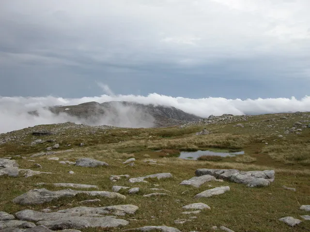
- Elevation
- 674 m
- above sea level
- Local time
- UTC+00:00
- Europe/Dublin · UTC+00:00
About Croaghgorm
Croaghgorm is a mountain. Location: County Donegal, Ulster. Elevation: 674 m.
Croaghgorm or Bluestack (from Irish an Chruach Gorm, meaning 'the blue stack') is a 674-metre (2,211 ft) mountain in County Donegal, Ireland. It is the highest of the Blue Stack Mountains (or Croaghgorms) and the third-highest mountain in County Donegal. On 31 January 1944, during World War II, a Royal Air Force (RAF) Sunderland plane crashed on the mountain. Seven RAF crewmen from 228 Squadron were killed. Wreckage from the plane can still be seen on the mountain's slopes. A memorial plaque was unveiled in 1988.
Read more on Wikipedia Text: Wikipedia contributors · CC BY-SA 4.0 · shortened
At a glance
- Topographic prominence
- 541 m
Source: Wikidata
In comparison
- No. 133 of 2106 mountains in Ireland by elevation
- 68 sights and natural places within 10 km An Chruach Ghorm mullach thiar theas, Blue Stack
Nearest towns and villages
-
Edergole Bridge Village, County Donegal3.6 km SE
-
Greenan Bridge Village, County Donegal4.2 km SE
-
Meenataggart Village, County Donegal4.7 km SW
-
Donegal Village, County Donegal11 km S
-
Lackcrom Village, County Donegal6.1 km SW
-
Garvagh Village, County Donegal6.3 km SE
Nearby attractions & nature
Everything nearby-
An Chruach Ghorm mullach thiar theas Mountain, County Donegal0.9 km SW
-
Blue Stack Mountain, County Donegal1.3 km W
-
An Chruach Ghorm (mullach thoir) Mountain, County Donegal1.4 km E
-
Lavagh More Mountain, County Donegal1.9 km NW
-
Croaghgorm Far South West Top Mountain, County Donegal1.8 km SW
-
Ard na gCaor Mountain, County Donegal2.5 km NE
-
Lough Gulladuff Lake, County Donegal2.5 km SE
-
An Leamhaigh Bheag Mountain, County Donegal2.9 km NW
Sources & licences
Data last updated: · 2 independent sources