Slieve Snaght
Local name: Sliabh Sneachta
Located in County Donegal, Ulster Coordinates: 55°11′47″ N 7°20′03″ W
- Elevation
- 615 m
- above sea level
- Local time
- UTC+00:00
- Europe/Dublin · UTC+00:00
About Slieve Snaght
Slieve Snaght is a mountain. Location: County Donegal, Ulster. Elevation: 615 m.
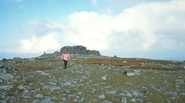
Slieve Snaght (Irish: Sliabh Sneachta, meaning 'snow mountain') is a mountain in the middle of the Inishowen peninsula of County Donegal, Ireland. It rises to a height of 615 metres (2,018 ft), making it the highest mountain in Inishowen, and is one of the northernmost mountains of Ireland. It should not be confused with the mountain of the same name in the nearby Derryveagh range. It includes the lesser summits of Slieve Main, Crocknamaddy and Damph.
Read more on Wikipedia Text: Wikipedia contributors · CC BY-SA 4.0 · shortened
In comparison
- No. 227 of 2106 mountains in Ireland by elevation
- 41 sights and natural places within 10 km Inishowen, Slieve Main
Nearest towns and villages
-
Carndonagh Village, County Donegal7.4 km NE
-
Turk Village, County Donegal3.4 km S
-
Meenyollan Village, County Donegal3.4 km E
-
Drumfree Village, County Donegal4 km W
-
Magheraboy Village, County Donegal4.1 km NW
-
Cashel Village, County Donegal4.8 km NE
Nearby attractions & nature
Everything nearby-
Inishowen Natural site, County Donegal0.4 km N
-
Slieve Main Mountain, County Donegal1.6 km SW
-
Damph Mountain, County Donegal2.1 km S
-
Tullymore Mountain, County Donegal2.3 km NE
-
Barnan More Mountain, County Donegal3.5 km NW
-
Crocknamaddy Mountain, County Donegal3.8 km SW
-
Trusk More Mountain, County Donegal3.6 km E
-
Illies Hill Mountain, County Donegal4.4 km S
Sources & licences
Data last updated: · 2 independent sources