Monte Cimone
Located in Chiusaforte, Province of Udine Coordinates: 46°25′23″ N 13°23′13″ E
- Elevation
- 2,379 m
- above sea level
- Local time
- UTC+01:00
- Europe/Rome · UTC+01:00
- Airports
- TRS Trieste Airport66 km
- KLU Klagenfurt Airport77 km
About Monte Cimone
Monte Cimone is a mountain. Location: Chiusaforte, Province of Udine. Elevation: 2,379 m. The nearest airport is Trieste Airport (66 km). Nearby sights include Altopiano di Montásio and Picco di Mezzodì.
Photos of Monte Cimone
-
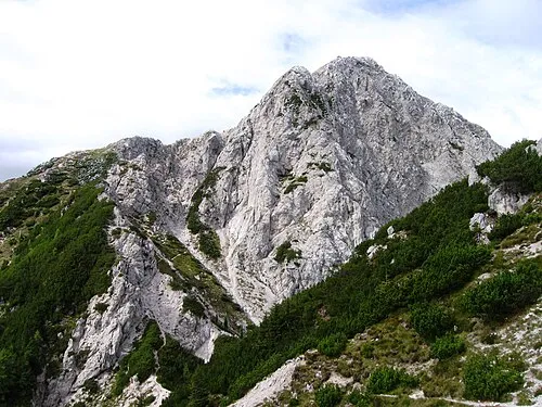
Jôf di Miezegnot JakobZ · CC BY-SA 3.0 -
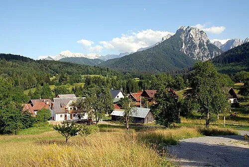
Val Canale Johann Jaritz · CC BY-SA 3.0 -
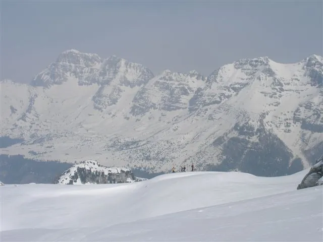
Altopiano di Montásio Original uploader was Johnmattiussi@yahoo.co.uk at it.wikipedia · Public domain


Climate of Monte Cimone
This month · November
A wet month
Day -3° · Night -10° · Rain 173 mm
- Hottest month
- July (day 12°)
- Coldest month
- January (night -14°)
- Wettest month
- June (181 mm)
- Driest month
- February (79 mm)
Bars: average monthly low and high temperature. Below: precipitation. Monthly averages for 1970–2000 at about 18 km resolution, adjusted for elevation. Highlighted months are mild and relatively dry. Source: WorldClim 2.1 (CC BY 4.0).
Show values as a table
| Month | Jan | Feb | Mar | Apr | May | Jun | Jul | Aug | Sep | Oct | Nov | Dec |
|---|---|---|---|---|---|---|---|---|---|---|---|---|
| Average high (°C) | -7° | -5° | -3° | 1° | 6° | 10° | 12° | 12° | 8° | 4° | -3° | -6° |
| Average low (°C) | -14° | -14° | -11° | -8° | -3° | 0° | 2° | 2° | -1° | -5° | -10° | -13° |
| Precipitation (mm) | 96 | 79 | 112 | 150 | 164 | 181 | 167 | 153 | 171 | 180 | 173 | 122 |
How to get to Monte Cimone
The nearest airport is Trieste Airport (TRS), 66 km to the south as the crow flies. The nearest large city is Klagenfurt, 74 km to the east.
Airports
- Trieste Airport (TRS) Ronchi dei Legionari/Trieste 66 kmsouth
- Klagenfurt Airport (KLU) Klagenfurt am Wörthersee 77 kmeast
- Ljubljana Jože Pučnik Airport (LJU) Zgornji Brnik 85 kmeast
Nearby large cities
- Klagenfurt Population: 100.3K 74 kmeast
- Ljubljana Population: 272.2K 96 kmsoutheast
- Rijeka Population: 108K 147 kmsoutheast
- Salzburg Population: 157.2K 155 kmnorth
- Graz Population: 303.3K 173 kmnortheast
Straight-line distances; road distances are longer. Airport data: OurAirports.
Day trips from Monte Cimone
Within 100 km: 145 historic and cultural sites, 2,001 natural sites, 481 lakes, rivers and coasts.
0–25 km105 places
- Prestreljenik Mountain 9 kmSE
- Mangrt Mountain 21 kmE
- Svinjak Mountain 20 kmSE
- Jalovec Mountain 23 kmE
25–60 km573 places
- Lake Bohinj Lake 40 kmSE
- Lake Bled Lake 55 kmE
- Triglav Mountain 35 kmE
- Rjavina Mountain 38 kmE
60–100 km1,949 places
- Raša River 78 kmSE
- Šmarna gora Mountain 89 kmE
- Mrzla Gora Mountain 92 kmE
- Hrušica Mountain 88 kmSE
Straight-line distances.
Nearest towns and villages
-
Saletto Village, Chiusaforte2.3 km S
-
Chiout Cali Village, Chiusaforte2.4 km SW
-
Tamaroz Village, Chiusaforte2.8 km SE
-
Piani di Qua Village, Chiusaforte3.2 km SE
-
Piani di Là Village, Chiusaforte3.5 km SE
-
Pezzeit Village, Chiusaforte3.4 km SW
Nearby attractions & nature
Everything nearby-
Altopiano di Montásio Natural site, Friuli Venezia Giulia4 km E
-
Picco di Mezzodì Mountain, Chiusaforte3.9 km S
-
Picco di Grubia Mountain, Resia5.9 km S
-
Monte Carnizza Mountain, Malborghetto Valbruna5.9 km NE
-
Clap Forat Mountain, Dogna6.3 km NW
-
Monte Nabois Mountain, Malborghetto Valbruna6.3 km E
-
Jôf di Miezegnot Mountain, Malborghetto Valbruna7.9 km NE
-
Modeon del Buinz Mountain, Malborghetto Valbruna6.7 km E
Sources & licences
Data last updated: · 2 independent sources