- Elevation
- 3,030 m
- above sea level
- Local time
- UTC+01:00
- Europe/Rome · UTC+01:00
- Airports
- BGY Il Caravaggio International Airport95 km
- BZO Bolzano Airport98 km
About Monte Garone
Monte Garone is a mountain. Location: Livigno, Province of Sondrio. Elevation: 3,030 m. The nearest airport is Il Caravaggio International Airport (95 km). Nearby sights include Monte Campacci and Monte Ganda.
Climate of Monte Garone
This month · November
A cold month
Day -6° · Night -13° · Rain 59 mm
- Hottest month
- August (day 8°)
- Coldest month
- February (night -17°)
- Wettest month
- July (86 mm)
- Driest month
- February (40 mm)
Bars: average monthly low and high temperature. Below: precipitation. Monthly averages for 1970–2000 at about 18 km resolution, adjusted for elevation. Highlighted months are mild and relatively dry. Source: WorldClim 2.1 (CC BY 4.0).
Show values as a table
| Month | Jan | Feb | Mar | Apr | May | Jun | Jul | Aug | Sep | Oct | Nov | Dec |
|---|---|---|---|---|---|---|---|---|---|---|---|---|
| Average high (°C) | -9° | -9° | -7° | -5° | 0° | 5° | 8° | 8° | 5° | 0° | -6° | -8° |
| Average low (°C) | -17° | -17° | -14° | -11° | -7° | -4° | -2° | -1° | -4° | -8° | -13° | -16° |
| Precipitation (mm) | 51 | 40 | 52 | 57 | 67 | 82 | 86 | 85 | 74 | 66 | 59 | 52 |
How to get to Monte Garone
The nearest airport is Il Caravaggio International Airport (BGY), 95 km to the south as the crow flies. The nearest large city is Innsbruck, 134 km to the northeast.
Airports
- Il Caravaggio International Airport (BGY) Orio al Serio (BG) 95 kmsouth
- Bolzano Airport (BZO) Bolzano (BZ) 98 kmeast
- Lugano Airport (LUG) Agno 103 kmsouthwest
Nearby large cities
- Innsbruck Population: 132.5K 134 kmnortheast
- Zurich Population: 415.4K 150 kmnorthwest
- Winterthur Population: 111.8K 151 kmnorthwest
- Bern Population: 121.6K 205 kmwest
- Ulm Population: 120.5K 212 kmnorth
Straight-line distances; road distances are longer. Airport data: OurAirports.
Day trips from Monte Garone
Within 100 km: 103 historic and cultural sites, 5,484 natural sites, 589 lakes, rivers and coasts.
0–25 km610 places
- Chaviolas Island 24 kmW
- Silvaplanersee Lake 20 kmW
- Lago di Poschiavo Lake 23 kmS
- Lej Languard Lake 7 kmW
25–60 km1,964 places
- Lajets Lake 35 kmW
- Lake Sils Lake 25 kmW
- Lägh da Cavloc Lake 29 kmSW
- Lake Davos Lake 40 kmN
60–100 km3,602 places
- Spadalone Mountain 64 kmSE
- Walensee Lake 96 kmNW
- Laghetto Lake 96 kmW
- Voralpsee Lake 90 kmNW
Straight-line distances.
Nearest towns and villages
Nearby attractions & nature
Everything nearby-
Monte Campacci Mountain, Livigno2.2 km NE
-
Monte Ganda Mountain, Livigno2.5 km SE
-
Pizzo Cantone Mountain, Livigno3.1 km NE
-
Munt Cotschen Mountain, Zuoz2.5 km N
-
Piz Chatscheders Mountain, Pontresina2.7 km SW
-
Piz Prünella Mountain, Madulain2.8 km W
-
Monte delle Rezze Mountain, Livigno3.6 km E
-
Chantun Mountain, Zuoz3.1 km W
More nature in Italy
-
Vetta Blesaccia Mountain, Livigno5.4 km NE
-
Monte del Buon Curato Mountain, Livigno5.6 km E
-
Monte Vago Mountain, Livigno5.7 km SE
-
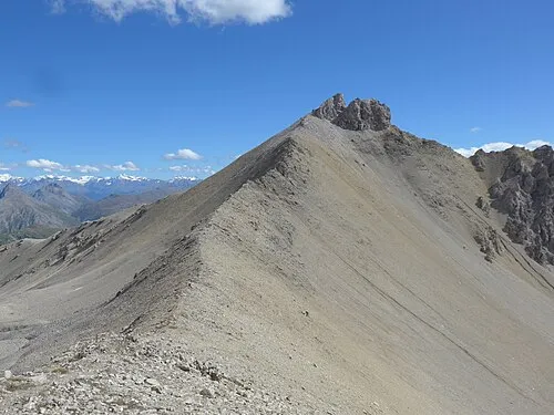 Punta Casana Mountain, Livigno9.2 km N
-
Monte delle Mine Mountain, Livigno7.3 km E
-
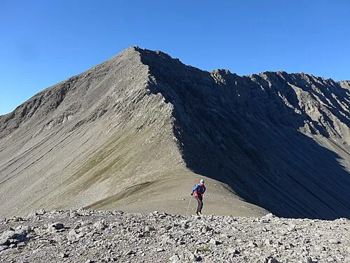 Piz Trupchun Mountain, Livigno11 km N
Sources & licences
Data last updated: · 2 independent sources