- Elevation
- 2,387 m
- above sea level
- Local time
- UTC+01:00
- Europe/Rome · UTC+01:00
- Airports
- LUG Lugano Airport59 km
- MXP Milan Malpensa International Airport83 km
About Monte del Sangiatto
Monte del Sangiatto is a mountain. Location: Baceno, Verbania. Elevation: 2,387 m.
Monte del Sangiatto is a mountain of Piedmont, Italy, with an elevation of 2,387 metres (7,831 ft). Part of the Lepontine Alps, it is located in the Valle Devero, inside the Alpe Veglia and Alpe Devero Natural Park. The mountain lies south of Monte Corbernas and can be reached on a hiking path starting from the Alpe Devero.
Source: Wikipedia · CC BY-SA 4.0
Photos of Monte del Sangiatto
-
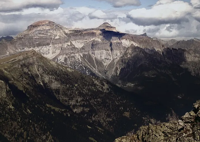
Pizzo Diei No machine-readable author provided. Idéfix~commonswiki assumed · CC BY-SA 3.0 -
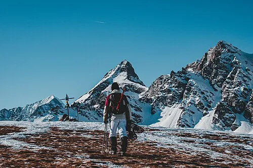
Monte Cazzola Andre.arduph · CC BY-SA 4.0 -
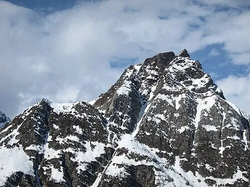
Pizzo Crampiolo sud Mænsard vokser · CC BY-SA 4.0


Climate of Monte del Sangiatto
This month · November
A cold month
Day -1° · Night -8° · Rain 86 mm
- Hottest month
- July (day 12°)
- Coldest month
- February (night -11°)
- Wettest month
- May (110 mm)
- Driest month
- February (64 mm)
Bars: average monthly low and high temperature. Below: precipitation. Monthly averages for 1970–2000 at about 18 km resolution, adjusted for elevation. Highlighted months are mild and relatively dry. Source: WorldClim 2.1 (CC BY 4.0).
Show values as a table
| Month | Jan | Feb | Mar | Apr | May | Jun | Jul | Aug | Sep | Oct | Nov | Dec |
|---|---|---|---|---|---|---|---|---|---|---|---|---|
| Average high (°C) | -4° | -3° | -1° | 1° | 6° | 9° | 12° | 12° | 9° | 4° | -1° | -3° |
| Average low (°C) | -11° | -11° | -9° | -7° | -3° | 1° | 4° | 4° | 1° | -3° | -8° | -10° |
| Precipitation (mm) | 67 | 64 | 80 | 96 | 110 | 106 | 95 | 105 | 92 | 104 | 86 | 68 |
How to get to Monte del Sangiatto
The nearest airport is Lugano Airport (LUG), 59 km to the southeast as the crow flies. For international flights: Milan Malpensa International Airport (MXP) (83 km). The nearest large city is Bern, 96 km to the northwest.
Airports
- Lugano Airport (LUG) Agno 59 kmsoutheast
- Milan Malpensa International Airport (MXP) Ferno (VA) 83 kmsoutheast
- Bern Airport (BRN) Bern 90 kmnorthwest
Nearby large cities
- Bern Population: 121.6K 96 kmnorthwest
- Zurich Population: 415.4K 118 kmnorth
- Lausanne Population: 139.1K 130 kmwest
- Winterthur Population: 111.8K 136 kmnorth
- Basel Population: 177.6K 149 kmnorth
Straight-line distances; road distances are longer. Airport data: OurAirports.
Day trips from Monte del Sangiatto
Within 100 km: 138 historic and cultural sites, 6,665 natural sites, 778 lakes, rivers and coasts.
0–25 km632 places
- Lago Nero Lake 24 kmNE
- Lago Sfundau Lake 24 kmNE
- Stausee Gibidum Lake 24 kmW
- Laghetti d'Antabia Lake 17 kmNE
25–60 km3,158 places
- Strandbad Neuhaus Beach 55 kmNW
- Strandbad Manor Farm Beach 55 kmNW
- Strandbad Leissigen Beach 55 kmNW
- Strandbad Iseltwald Beach 51 kmNW
60–100 km3,791 places
- Kleiner Bremgartenwald Mountain 98 kmNW
- Insel Schwanau Island 83 kmN
- Sankt-Niklausen-Insle Island 80 kmN
- Neptun-Inseln Island 68 kmN
Straight-line distances.
Nearest towns and villages


Nearby attractions & nature
Everything nearby-
Monte Corbernas Mountain, Baceno1.2 km NE
-
Corona Troggi Mountain, Premia1.3 km S
-
Pizzo Nava Mountain, Premia1.7 km S
-
Gli Orli Mountain, Baceno2.1 km W
-
Pizzo Topera Mountain, Premia2.7 km E
-
Monte Forno Mountain, Premia2.8 km SE
-
Punta della Valle Mountain, Baceno2.9 km NE
-
Stange Mountain, Baceno2.9 km NW
More nature in Italy
-
Pizzo Fizzo Mountain, Baceno3.4 km NW
-
Monte Cazzola Mountain, Baceno5.2 km SW
-
Pizzo Crampiolo sud Mountain, Baceno3.5 km NW
-
Monte Croce Mountain, Baceno3.7 km NW
-
La Pizzetta Mountain, Baceno4.1 km SE
-
Grampielhorn Mountain, Baceno4.3 km NW
Sources & licences
Data last updated: · 2 independent sources