Pizzo la Scheggia
Located in Santa Maria Maggiore, Verbania Coordinates: 46°11′08″ N 8°25′15″ E
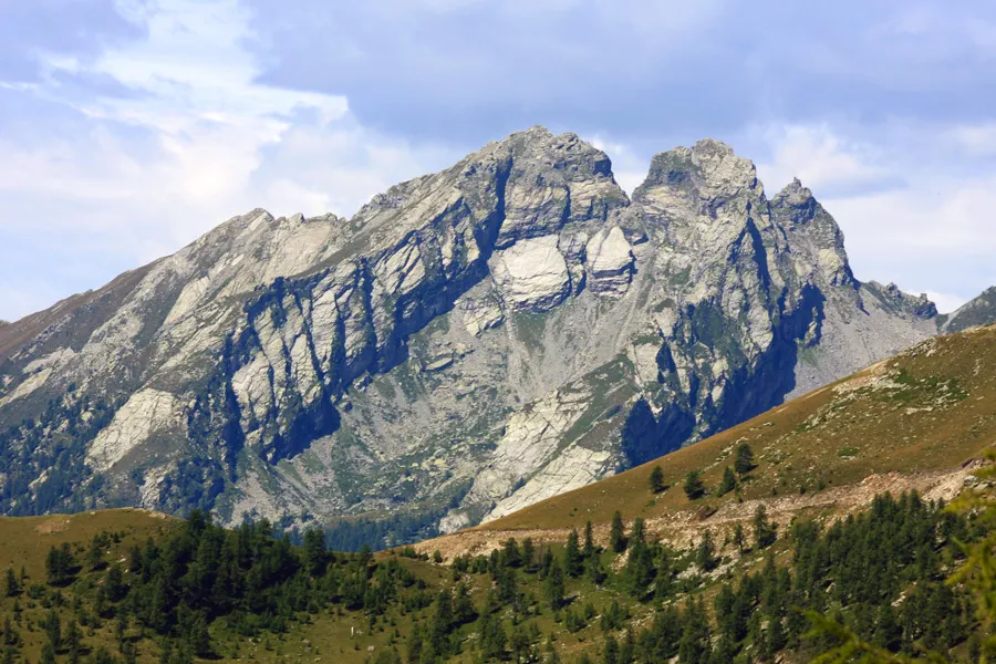
- Elevation
- 2,466 m
- above sea level
- Local time
- UTC+01:00
- Europe/Rome · UTC+01:00
- Airports
- LUG Lugano Airport43 km
- MXP Milan Malpensa International Airport66 km
About Pizzo la Scheggia
Pizzo la Scheggia is a mountain. Location: Santa Maria Maggiore, Verbania. Elevation: 2,466 m.
Pizzo La Scheggia is a mountain of Piedmont, Italy, with an elevation of 2,466 metres (8,091 ft). It is located in the Lepontine Alps, in the Province of Verbano-Cusio-Ossola, and is part of the Onsermone massif. Located west of the Pioda di Crana, Pizzo La Scheggia is the highest mountain of Val Vigezzo. It owes its name (Scheggia for scheggiatura, "chip") due to the crack that separates it from the nearby Cima Campelli. The peak can be reached by a hiking path from Arvogno, a hamlet of Toceno.
Source: Wikipedia · CC BY-SA 4.0
Photos of Pizzo la Scheggia
-

Mænsard vokser · CC BY-SA 4.0 -

Mænsard vokser · CC BY-SA 4.0 -

Dira0101 · CC BY-SA 4.0


Climate of Pizzo la Scheggia
This month · November
A cold month
Day -1° · Night -8° · Rain 91 mm
- Hottest month
- July (day 12°)
- Coldest month
- February (night -11°)
- Wettest month
- May (121 mm)
- Driest month
- February (63 mm)
Bars: average monthly low and high temperature. Below: precipitation. Monthly averages for 1970–2000 at about 18 km resolution, adjusted for elevation. Highlighted months are mild and relatively dry. Source: WorldClim 2.1 (CC BY 4.0).
Show values as a table
| Month | Jan | Feb | Mar | Apr | May | Jun | Jul | Aug | Sep | Oct | Nov | Dec |
|---|---|---|---|---|---|---|---|---|---|---|---|---|
| Average high (°C) | -4° | -4° | -2° | 0° | 5° | 9° | 12° | 12° | 8° | 4° | -1° | -3° |
| Average low (°C) | -11° | -11° | -10° | -7° | -3° | 0° | 3° | 3° | 0° | -4° | -8° | -10° |
| Precipitation (mm) | 69 | 63 | 82 | 106 | 121 | 116 | 105 | 115 | 105 | 115 | 91 | 71 |
How to get to Pizzo la Scheggia
The nearest airport is Lugano Airport (LUG), 43 km to the southeast as the crow flies. For international flights: Milan Malpensa International Airport (MXP) (66 km). The nearest large city is Bern, 113 km to the northwest.
Airports
- Lugano Airport (LUG) Agno 43 kmsoutheast
- Milan Malpensa International Airport (MXP) Ferno (VA) 66 kmsouth
- Milano Linate Airport (LIN) Segrate (MI) 106 kmsoutheast
Nearby large cities
- Bern Population: 121.6K 113 kmnorthwest
- Zurich Population: 415.4K 132 kmnorth
- Lausanne Population: 139.1K 142 kmwest
- Winterthur Population: 111.8K 149 kmnorth
- Basel Population: 177.6K 166 kmnorthwest
Straight-line distances; road distances are longer. Airport data: OurAirports.
Day trips from Pizzo la Scheggia
Within 100 km: 110 historic and cultural sites, 6,311 natural sites, 731 lakes, rivers and coasts.
0–25 km413 places
- Sant' Apollinare Island 25 kmE
- San Pancrazio Island 25 kmE
- Laghetti d'Antabia Lake 23 kmN
- Laghi di Formazzöö Lake 19 kmN
25–60 km2,649 places
- Lago Nero Lake 31 kmN
- Isole di Brissago Island 25 kmE
- Lago Tremorgio Lake 40 kmNE
- Lago Sfundau Lake 32 kmN
60–100 km4,090 places
- Strandbad Neuhaus Beach 72 kmNW
- Strandbad Manor Farm Beach 72 kmNW
- Strandbad Leissigen Beach 72 kmNW
- Strandbad Iseltwald Beach 68 kmNW
Straight-line distances.
Nearest towns and villages


Nearby attractions & nature
Everything nearby-
Pizzo Locciabella Mountain, Montecrestese0.9 km SW
-
Cima dei Casaletti Mountain, Montecrestese0.9 km N
-
Pizzo Cazzola Mountain, Masera2.3 km SW
-
Loccie del Forgnone Mountain, Montecrestese2.3 km NW
-
Monte Loccia di Peve Mountain, Masera2.5 km SW
-
Monte Mater Mountain, Druogno2.7 km S
-
Cima di Canogia Mountain, Montecrestese2.7 km N
-
Monte Margineta Mountain, Druogno2.8 km S
Sources & licences
Data last updated: · 2 independent sources