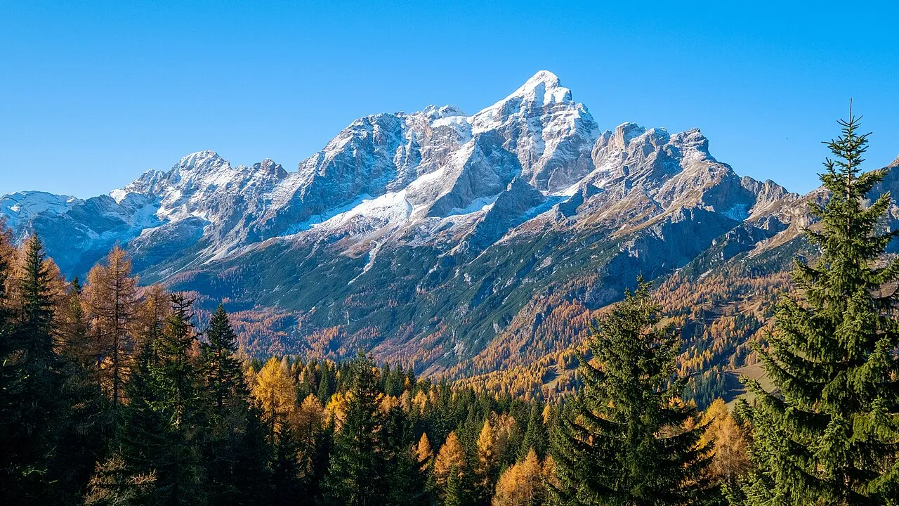
- Elevation
- 3,220 m
- above sea level
- Local time
- UTC+01:00
- Europe/Rome · UTC+01:00
- Airports
- BZO Bolzano Airport57 km
- TSF Treviso Airport82 km
About Monte Civetta
Monte Civetta is a mountain. Location: Province of Belluno, Veneto. Elevation: 3,220 m.
Monte Civetta (3,220 m) is a prominent and major mountain of the Dolomites, in the Province of Belluno in northern Italy. Its north-west face can be viewed from the Taibon Agordino valley, and is classed as one of the symbols of the Dolomites. The mountain is thought to have been first climbed by Simeone di Silvestro in 1855, which, if true, makes it the first major Dolomite peak to be climbed.
Source: Wikipedia · CC BY-SA 4.0
At a glance
- Topographic prominence
- 1,447 m
Source: Wikidata
Photos of Monte Civetta
-

This Photo was taken by Wolfgang Moroder . Feel free to use my photos, but please mention me as the author and send me a · CC BY-SA 3.0 -

This Photo was taken by Wolfgang Moroder . Feel free to use my photos, but please mention me as the author and send me a · CC BY-SA 4.0 -

Edward Theodore Compton · Public domain -

Hans Braam · CC BY 3.0 -

kallerna · CC BY-SA 4.0


Climate of Monte Civetta
This month · November
A cold month
Day -7° · Night -13° · Rain 82 mm
- Hottest month
- July (day 7°)
- Coldest month
- February (night -17°)
- Wettest month
- July (143 mm)
- Driest month
- January (45 mm)
Bars: average monthly low and high temperature. Below: precipitation. Monthly averages for 1970–2000 at about 18 km resolution, adjusted for elevation. Highlighted months are mild and relatively dry. Source: WorldClim 2.1 (CC BY 4.0).
Show values as a table
| Month | Jan | Feb | Mar | Apr | May | Jun | Jul | Aug | Sep | Oct | Nov | Dec |
|---|---|---|---|---|---|---|---|---|---|---|---|---|
| Average high (°C) | -11° | -10° | -7° | -4° | 1° | 5° | 7° | 7° | 4° | -1° | -7° | -10° |
| Average low (°C) | -17° | -17° | -14° | -12° | -7° | -3° | -1° | -1° | -4° | -8° | -13° | -16° |
| Precipitation (mm) | 45 | 47 | 59 | 74 | 110 | 130 | 143 | 135 | 106 | 95 | 82 | 48 |
How to get to Monte Civetta
The nearest airport is Bolzano Airport (BZO), 57 km to the west as the crow flies. For international flights: Treviso Airport (TSF) (82 km). The nearest large city is Innsbruck, 110 km to the northwest.
Airports
- Bolzano Airport (BZO) Bolzano (BZ) 57 kmwest
- Treviso Airport (TSF) Treviso (TV) 82 kmsouth
- Venice Marco Polo Airport (VCE) Venezia (VE) 100 kmsouth
Nearby large cities
- Innsbruck Population: 132.5K 110 kmnorthwest
- Klagenfurt Population: 100.3K 175 kmeast
- Salzburg Population: 157.2K 175 kmnortheast
- Ljubljana Population: 272.2K 193 kmeast
- Munich Population: 1.5M 199 kmnorth
Straight-line distances; road distances are longer. Airport data: OurAirports.
Day trips from Monte Civetta
Within 100 km: 47 historic and cultural sites, 2,696 natural sites, 242 lakes, rivers and coasts.
0–25 km230 places
- Croda Nera Mountain 22 kmW
- Nemesis Mountain 19 kmN
- Sasso di Valfredda Mountain 16 kmW
- Tofana di Mezzo Mountain 19 kmN
25–60 km694 places
- Sille River 53 kmNE
- Piz Gralba Mountain 25 kmNW
- Piz Miara Mountain 25 kmNW
- Thurntaler Seen Lake 49 kmNE
60–100 km2,061 places
- Fürlegsee Lake 94 kmNE
- Vorderer Langtalsee Lake 89 kmNE
- Eissee Lake 80 kmN
- Schwarzkarlsee Lake 99 kmNE
Straight-line distances.
Nearest towns and villages
-
Alleghe Municipality, Province of Belluno3.7 km NW
-
Masarè Village, Alleghe3.6 km NW
-
Alleghe Village, Alleghe3.8 km NW
-
San Tomaso Agordino Municipality, Province of Belluno6.1 km W
-
Mareson-Pecol Village, Val di Zoldo4.5 km E
-
Coldemies Village, Alleghe4.1 km NW
Nearby attractions & nature
Everything nearby-
Piccola Civetta Mountain, Province of Belluno0.4 km SW
-
Punta Civetta Mountain, Province of Belluno0.5 km NE
-
Punta de Gasperi Mountain, Trentino-Alto Adige1 km W
-
Torre di Val Grande Mountain, Trentino-Alto Adige1.1 km NE
-
Schienal del Bec Mountain, Val di Zoldo1.1 km NE
-
Torre di Alleghe Mountain, Trentino-Alto Adige1.3 km NE
-
Torre Coldai Mountain, Trentino-Alto Adige1.6 km NE
-
Cima della Busazza Mountain, Trentino-Alto Adige1.8 km SW
More nature in Italy
-
Monte Moiazzetta Mountain, Province of Belluno1.9 km SE
-
Cima delle Sasse Mountain, Province of Belluno2.7 km S
-
Col Vallon Mountain, Val di Zoldo3.4 km NE
-
La Palazza Alto Mountain, Taibon Agordino5.6 km S
-
 Monte Tamer Mountain, La Valle Agordina9.4 km SE
-
Piz Zorlet Mountain, Rocca Pietore8.8 km W
Sources & licences
Data last updated: · 2 independent sources