Antelao
Located in San Vito di Cadore, Province of Belluno Coordinates: 46°27′08″ N 12°15′42″ E
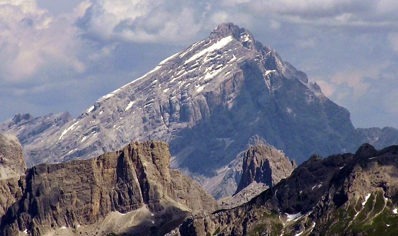
- Elevation
- 3,264 m
- above sea level
- Local time
- UTC+01:00
- Europe/Rome · UTC+01:00
- Airports
- BZO Bolzano Airport72 km
- TSF Treviso Airport89 km
About Antelao
Antelao is a mountain. Location: San Vito di Cadore, Province of Belluno. Elevation: 3,264 m.
Monte Antelao (Cadorino dialect: Nantelòu) is the highest mountain in the eastern Dolomites (a section of the Alps) in northeastern Italy, southeast of the town of Cortina d'Ampezzo, in the region of Cadore. The Monte Antelao is an ultra-prominent peak (Ultra). It is known as the "King of the Dolomites" (Marmolada, the highest of all the Dolomites, is the "Queen" although composed mostly of limestones).
Source: Wikipedia · CC BY-SA 4.0
At a glance
- Topographic prominence
- 1,735 m
Source: Wikidata
Photos of Antelao
-

Giorgio Galeotti · CC BY-SA 4.0 -

Ximonic · CC BY-SA 4.0 -

Ximonic · CC BY-SA 4.0 -

kallerna · CC BY-SA 4.0 -

Labaracca · CC BY-SA 4.0


Climate of Antelao
This month · November
A cold month
Day -8° · Night -14° · Rain 79 mm
- Hottest month
- July (day 7°)
- Coldest month
- January (night -18°)
- Wettest month
- July (133 mm)
- Driest month
- January (43 mm)
Bars: average monthly low and high temperature. Below: precipitation. Monthly averages for 1970–2000 at about 18 km resolution, adjusted for elevation. Highlighted months are mild and relatively dry. Source: WorldClim 2.1 (CC BY 4.0).
Show values as a table
| Month | Jan | Feb | Mar | Apr | May | Jun | Jul | Aug | Sep | Oct | Nov | Dec |
|---|---|---|---|---|---|---|---|---|---|---|---|---|
| Average high (°C) | -12° | -11° | -8° | -4° | 1° | 4° | 7° | 7° | 3° | -2° | -8° | -11° |
| Average low (°C) | -18° | -18° | -15° | -12° | -8° | -4° | -2° | -2° | -5° | -9° | -14° | -17° |
| Precipitation (mm) | 43 | 45 | 57 | 73 | 106 | 123 | 133 | 125 | 101 | 94 | 79 | 48 |
How to get to Antelao
The nearest airport is Bolzano Airport (BZO), 72 km to the west as the crow flies. For international flights: Treviso Airport (TSF) (89 km). The nearest large city is Innsbruck, 112 km to the northwest.
Airports
- Bolzano Airport (BZO) Bolzano (BZ) 72 kmwest
- Treviso Airport (TSF) Treviso (TV) 89 kmsouth
- Venice Marco Polo Airport (VCE) Venezia (VE) 105 kmsouth
Nearby large cities
- Innsbruck Population: 132.5K 112 kmnorthwest
- Klagenfurt Population: 100.3K 158 kmeast
- Salzburg Population: 157.2K 161 kmnorth
- Ljubljana Population: 272.2K 179 kmeast
- Munich Population: 1.5M 194 kmnorth
Straight-line distances; road distances are longer. Airport data: OurAirports.
Day trips from Antelao
Within 100 km: 68 historic and cultural sites, 2,712 natural sites, 337 lakes, rivers and coasts.
0–25 km171 places
- Nemesis Mountain 20 kmNW
- Tofana di Mezzo Mountain 19 kmNW
- Tofana di Dentro Mountain 19 kmNW
- Croda Rossa Mountain 22 kmNW
25–60 km875 places
- Sille River 39 kmN
- Piz Gralba Mountain 37 kmW
- Piz Miara Mountain 37 kmW
- Croda Nera Mountain 37 kmW
60–100 km2,071 places
- Prestreljenik Mountain 94 kmE
- Fürlegsee Lake 80 kmN
- Vorderer Langtalsee Lake 73 kmNE
- Eissee Lake 69 kmN
Straight-line distances.
Nearest towns and villages
-
San Vito di Cadore Village, San Vito di Cadore4.4 km W
-
Vodo di Cadore Village, Vodo Cadore3.9 km S
-
Borca di Cadore Municipality, Province of Belluno3.7 km SW
-
Vodo Cadore Municipality, Province of Belluno3.8 km S
-
Borca di Cadore Village, Borca di Cadore3.6 km SW
-
Serdes Village, San Vito di Cadore4.6 km W
Nearby attractions & nature
Everything nearby-
Cima Cadìn Mountain, Friuli Venezia Giulia2.2 km NE
-
Monte Ciaudierona Mountain, Calalzo di Cadore3 km NE
-
Col Vida Mountain, Vodo Cadore3.7 km SE
-
Cima Bastion Mountain, Trentino-Alto Adige3.7 km N
-
Cima Bel Pra Mountain, Trentino-Alto Adige3.9 km NW
-
Punta Taiola Mountain, Trentino-Alto Adige4.7 km NW
-
Torre Sabbioni Mountain, Trentino-Alto Adige4.8 km NW
-
Monte Oten Mountain, Calalzo di Cadore5.5 km NE
Sources & licences
Data last updated: · 2 independent sources