- Local time
- UTC+01:00
- Europe/Oslo · UTC+01:00
- Elevation
- 920 m
- above sea level
- Airports
- RRS Røros Airport100 km
- MOL Molde Airport, Årø132 km
About Eysteinkyrkja
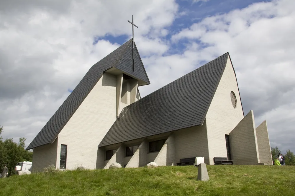
Eysteinkyrkja is a tourist attraction. Location: Dovre, Innlandet.
Eystein Church (Norwegian: Eysteinkyrkja) is a parish church of the Church of Norway in Dovre Municipality in Innlandet county, Norway. It is located in the village of Hjerkinn. It is one of the two churches for the Dombås parish which is part of the Nord-Gudbrandsdal prosti (deanery) in the Diocese of Hamar. The white, modern, cast concrete church was built in a long church design in 1969 using plans drawn up by the architects Magnus Poulsson and Anton Poulsson. The church seats about 110 people.
Source: Wikipedia · CC BY-SA 4.0
At a glance
- Built
- 1969
- Architect
- Magnus Poulsson
- Heritage designation
- cultural heritage preservation in Norway
Source: Wikidata
Climate of Eysteinkyrkja
This month · November
A cold month
Day -1° · Night -7° · Rain 41 mm
- Hottest month
- July (day 15°)
- Coldest month
- February (night -10°)
- Wettest month
- July (84 mm)
- Driest month
- April (25 mm)
Bars: average monthly low and high temperature. Below: precipitation. Monthly averages for 1970–2000 at about 18 km resolution, adjusted for elevation. Highlighted months are mild and relatively dry. Source: WorldClim 2.1 (CC BY 4.0).
Show values as a table
| Month | Jan | Feb | Mar | Apr | May | Jun | Jul | Aug | Sep | Oct | Nov | Dec |
|---|---|---|---|---|---|---|---|---|---|---|---|---|
| Average high (°C) | -4° | -4° | -2° | 2° | 9° | 13° | 15° | 14° | 9° | 4° | -1° | -3° |
| Average low (°C) | -10° | -10° | -8° | -5° | 1° | 4° | 6° | 6° | 2° | -2° | -7° | -9° |
| Precipitation (mm) | 41 | 32 | 34 | 25 | 37 | 66 | 84 | 72 | 62 | 53 | 41 | 41 |
How to get to Eysteinkyrkja
The nearest airport is Røros Airport (RRS), 100 km to the northeast as the crow flies. The nearest large city is Trondheim, 141 km to the north.
Airports
- Røros Airport (RRS) Røros 100 kmnortheast
- Molde Airport, Årø (MOL) Årø 132 kmnorthwest
- Kristiansund Airport, Kvernberget (KSU) Kvernberget 133 kmnorthwest
Nearby large cities
- Trondheim Population: 216.5K 141 kmnorth
- Oslo Population: 1.1M 265 kmsouth
- Drammen Population: 106K 278 kmsouth
- Bergen Population: 294K 305 kmsouthwest
Straight-line distances; road distances are longer. Airport data: OurAirports.
Nearest towns and villages

Sources & licences
Data last updated: · 2 independent sources