Domaniów
Located in Oława County, Lower Silesian Voivodeship Coordinates: 50°54′49″ N 17°09′01″ E
- Population
- 5,215
- 5.2K
- Elevation
- 141 m
- above sea level
- Local time
- UTC+01:00
- Europe/Warsaw · UTC+01:00
- Places inside
- 3
- listed under Domaniów
About Domaniów
Domaniów is a municipality. Location: Oława County, Lower Silesian Voivodeship. Population: 5,215. Elevation: 141 m.
In comparison
- No. 4 of 4 places in Oława County by population
- Nearest larger town: Oława, 6 km E
- Listed here: Village: 3
Places in Domaniów
3 places-
Wierzbno Village1K
-
Gmina Domaniów Village759
-
Kończyce Village247
Nearby attractions & nature
Everything nearby-
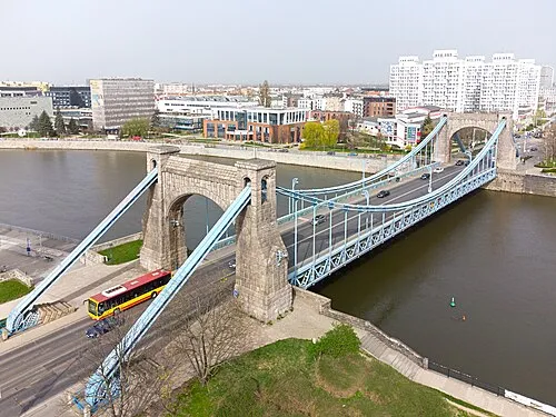 Grunwaldzki Bridge Landmark, Wrocław23 km N
-
Breslau I Concentration Camp Historic site, Stare Miasto23 km N
-
Breslau II Concentration Camp Historic site, Stare Miasto23 km N
-
Early Camp Breslau-Dürrgoy Historic site, Stare Miasto23 km N
-
Fünfteichen Concentration Camp Historic site, Gmina Jelcz-Laskowice19 km NE
-
Gora Gromnik Mountain, Przeworno24 km S
-
Brieg Concentration Camp Historic site, Brzeg23 km E
Sources & licences
Data last updated: