Mogadouro Municipality
Located in Braganza District, Portugal Coordinates: 41°20′31″ N 6°43′10″ W
- Population
- 9,542
- 9.5K
- Elevation
- 705 m
- above sea level
- Local time
- UTC+00:00
- Europe/Lisbon · UTC+00:00
- Places inside
- 21
- listed under Mogadouro Municipality
About Mogadouro Municipality
Mogadouro Municipality is a district. Location: Braganza District, Portugal. Population: 9,542.
In comparison
- 8 sights and natural places within 10 km Castelo de Mogadouro, Serra do Mogadouro
- Listed here: Municipality: 21
Places in Mogadouro Municipality
21 places- 3.6K
-
Bemposta Municipality497
- 357
-
Castelo Branco Municipality330
-
União das freguesias de Remondes e Soutelo Municipality285
-
Penas Roias Municipality278
-
Castro Vicente Municipality265
-
São Martinho do Peso Municipality255
-
Meirinhos Municipality250
-
Urrós Municipality250
-
Azinhoso Municipality241
-
Vila de Ala Municipality231
- 216
-
Brunhoso Municipality212
-
Peredo da Bemposta Municipality185
-
Bruçó Municipality166
-
Vale da Madre Municipality165
-
Tó Municipality136
-
Saldanha Municipality133
-
Paradela Municipality127
-
Travanca Municipality119
Nature and heritage in Mogadouro Municipality
-
Castelo de Mogadouro Historic site, União das freguesias de Mogadouro, Valverde, Vale de Porco e Vilar de Rei
-
Serra de Zava Mountain, União das freguesias de Mogadouro, Valverde, Vale de Porco e Vilar de Rei
-
Serra de Variz Mountain, Vila de Ala
-
Serrinho Mountain, Penas Roias
-
Cabeço do Poio Mountain, Azinhoso
-
Serra de Figueira Mountain, União das freguesias de Mogadouro, Valverde, Vale de Porco e Vilar de Rei
Nearby attractions & nature
Everything nearby-
Serra do Mogadouro Mountain, Braganza District2.3 km SE
-
Serra de Bruçó Mountain, Braganza District10 km S
-
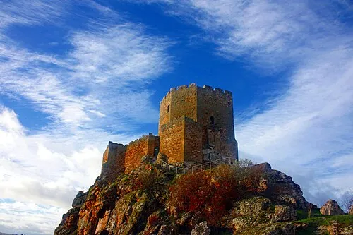 Castelo de Algoso Historic site, União das freguesias de Algoso, Campo de Víboras e Uva18 km NE
-
Monte de Morais Mountain, Braganza District21 km NW
-
Picão do Coxo Mountain, União das freguesias de Algoso, Campo de Víboras e Uva19 km NE
-
Serra de Sendim da Serra Mountain, Braganza District23 km W
Sources & licences
Data last updated: