Vale do Côa
Located in Pinhel Municipality, Guarda District Coordinates: 40°53′21″ N 7°07′42″ W
- Population
- 172
- 172
- Elevation
- 497 m
- above sea level
- Local time
- UTC+00:00
- Europe/Lisbon · UTC+00:00
About Vale do Côa
Vale do Côa is a municipality. Location: Pinhel Municipality, Guarda District. Population: 172. Elevation: 497 m.
In comparison
- No. 15 of 18 places in Pinhel Municipality by population
- Nearest larger town: União das freguesias de Freixeda do Torrão, Quintã de Pêro Martins e Penha de Águia, 6 km E
Nearby attractions & nature
Everything nearby-
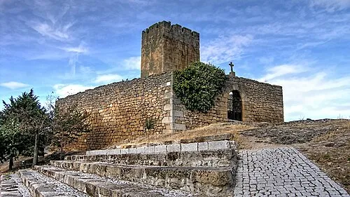 Castelo de Longroiva Historic site, Longroiva11 km NW
-
Serra do Sirigo Mountain, Viseu District23 km W
-
Fuente Romana Historic site, Fregeneda, La25 km NE
-
Río Morgaez River, Sobradillo24 km E
Sources & licences
Data last updated: