Leiria Municipality
Located in Leiria District, Portugal Coordinates: 39°44′47″ N 8°48′22″ W
- Population
- 126,897
- 126.9K
- Elevation
- 38 m
- above sea level
- Local time
- UTC+00:00
- Europe/Lisbon · UTC+00:00
- Places inside
- 20
- listed under Leiria Municipality
About Leiria Municipality
Leiria Municipality is a district. Location: Leiria District, Portugal. Population: 126,897.
Leiria (European Portuguese pronunciation: [lɐjˈɾi.ɐ] ) is a city and municipality in the Central Region of Portugal. It is the second largest city in that same region, after Coimbra, with a municipality population of 128,640 (as of 2021) in an area of 565.09 square kilometres (218.18 sq mi). It is the seat of its own district and the Roman Catholic Diocese of Leiria-Fátima. The city is part of the historical province of Beira Litoral.
Read more on Wikipedia Text: Wikipedia contributors · CC BY-SA 4.0 · shortened
At a glance
- Built
- 1142
- Area
- 565 km²
Source: Wikidata
In comparison
- Listed here: Municipality: 20
Places in Leiria Municipality
20 places- 34.6K
-
União das freguesias de Marrazes e Barosa Municipality26.2K
-
Maceira Municipality9.1K
-
União das freguesias de Parceiros e Azoia Municipality7.5K
-
União das freguesias de Monte Real e Carvide Municipality5.5K
-
Amor Municipality4.6K
- 4.6K
-
Monte Redondo Municipality4.4K
-
Caranguejeira Municipality4.3K
-
União das freguesias de Santa Eufémia e Boa Vista Municipality4.1K
-
Souto de Carpalhosa Municipality3.9K
-
União das freguesias de Colmeias e Memória Municipality3.7K
-
Milagres Municipality2.8K
-
Arrabal Municipality2.6K
-
Bidoeira de Cima Municipality2.2K
-
Regueira de Pontes Municipality2.2K
-
Ortigosa Municipality2K
-
Bajouca Municipality1.9K
-
Coimbrão Municipality1.7K
-
Carreira Municipality1.2K
Nearby attractions & nature
Everything nearby-
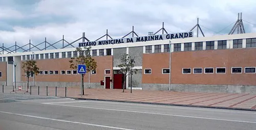 Estádio Municipal da Marinha Grande Landmark, Marinha Grande11 km W
-
Caramulo Mountain, Reguengo do Fetal12 km SE
-
Serra de Porto de Mós Mountain, Leiria District22 km S
-
Cabeço da Giesteira Mountain, Santarém District20 km SE
-
Serra Galega Mountain, Alqueidão da Serra17 km S
-
Serra da Bonha Mountain, Leiria District20 km NE
Sources & licences
Data last updated: · 2 independent sources