Lousada Municipality
Located in Porto District, Portugal Coordinates: 41°17′01″ N 8°16′28″ W
- Population
- 47,387
- 47.4K
- Elevation
- 264 m
- above sea level
- Local time
- UTC+00:00
- Europe/Lisbon · UTC+00:00
- Places inside
- 16
- listed under Lousada Municipality
About Lousada Municipality
Lousada Municipality is a district. Location: Porto District, Portugal. Population: 47,387.
In comparison
- 4 sights and natural places within 10 km Monte do Telégrafo, Serra dos Campelos
- Listed here: Municipality: 16
Places in Lousada Municipality
16 places-
União das freguesias de Cristelos, Boim e Ordem Municipality7.6K
- 6.6K
-
Lustosa Municipality4.8K
-
Meinedo Municipality3.8K
-
União das freguesias de Nespereira e Casais Municipality3.4K
-
Nevogilde Municipality2.5K
-
Torno Municipality2.5K
-
Caíde de Rei Municipality2.4K
-
União das freguesias de Figueiras e Covas Municipality2.1K
- 2.1K
-
Aveleda Municipality2.1K
-
Lodares Municipality2.1K
-
Sousela Municipality1.8K
-
Vilar do Torno e Alentém Municipality1.3K
-
Macieira Municipality1.3K
-
Barrosas (Santo Estêvão) Municipality983
Nature and heritage in Lousada Municipality
-
Monte do Telégrafo Mountain, União das freguesias de Silvares, Pias, Nogueira e Alvarenga
-
Serra dos Campelos Mountain, Lustosa
Nearby attractions & nature
Everything nearby-
Serra de São Tiago Mountain, Sobrosa6.3 km SW
-
 Estádio Municipal 25 de Abril Landmark, Penafiel8 km S
-
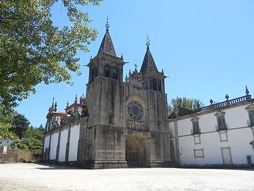 Monastery of Santa Maria de Pombeiro Attraction, Pombeiro de Ribavizela12 km N
-
Serra de Luzim Mountain, Porto District13 km S
-
Pico Alto Mountain, Penamaior12 km W
-
Alto do Picoto Mountain, Abragão12 km S
Sources & licences
Data last updated: