Mouriscas
Located in Abrantes Municipality, Santarém District Coordinates: 39°30′19″ N 8°05′43″ W
- Population
- 1,480
- 1.5K
- Elevation
- 184 m
- above sea level
- Local time
- UTC+00:00
- Europe/Lisbon · UTC+00:00
About Mouriscas
Mouriscas is a municipality. Location: Abrantes Municipality, Santarém District. Population: 1,480. Elevation: 184 m.
Mouriscas is a Portuguese freguesia ("civil parish"), located in Abrantes Municipality, in Santarém District. The population in 2011 was 1,832, in an area of 35.02 km2. The parish stands in the north bank of the Tagus River and borders the parishes of Concavada, Pego and Alferrarede. It also borders the Mação Municipality and Sardoal Municipality.
Read more on Wikipedia Text: Wikipedia contributors · CC BY-SA 4.0 · shortened
At a glance
- Area
- 35 km²
Source: Wikidata
In comparison
- No. 6 of 13 places in Abrantes Municipality by population
- Nearest larger town: Sardoal, 6 km NW
Nearby attractions & nature
Everything nearby-
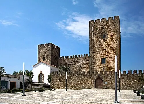 Castle of Amieira do Tejo Historic site, União das freguesias de Arez e Amieira do Tejo24 km E
-
Alto do Vale de Colmeias Mountain, União das freguesias de Gavião e Atalaia16 km E
-
Alto do Pé da Travessa Mountain, Belver16 km E
-
Vale do Peral Natural site, Santarém District18 km E
-
Serra da Amêndoa Mountain, Santarém District17 km NE
Sources & licences
Data last updated: · 2 independent sources