Curalha
Located in Chaves Municipality, Vila Real District Coordinates: 41°43′08″ N 7°31′10″ W
- Population
- 416
- 416
- Elevation
- 441 m
- above sea level
- Local time
- UTC+00:00
- Europe/Lisbon · UTC+00:00
About Curalha
Curalha is a municipality. Location: Chaves Municipality, Vila Real District. Population: 416. Elevation: 441 m.
In comparison
- No. 25 of 39 places in Chaves Municipality by population
- Nearest larger town: Vale de Anta, 3 km NE
- 4 sights and natural places within 10 km Castelo de Chaves, Serra da Ribeira
Airports nearest to Curalha
- Vila Real Airport (VRL) Vila Real 52 km
- Bragança Airport (BGC) Bragança 69 km
- Vigo Airport (VGO) Vigo 108 km
Straight-line distance; airports with scheduled flights only. Source: OurAirports (public domain).
Nearby attractions & nature
Everything nearby-
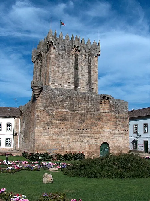 Castelo de Chaves Historic site, Santa Maria Maior4.6 km NE
-
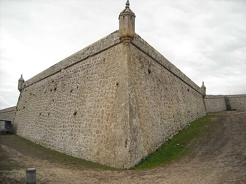 Forte de São Neutel Historic site, Santa Maria Maior5.6 km NE
-
Serra da Ribeira Mountain, União das freguesias de Soutelo e Seara Velha5.4 km N
-
Serra de Paranhos Mountain, União das freguesias de Santa Cruz/Trindade e Sanjurge7.2 km N
-
Alto da Mó Mountain, Ervededo12 km N
-
Alto das Penedas Mountain, Vilela Seca13 km N
-
Serra de Leiranco Mountain, Vila Real District12 km W
-
Serra do Miradouro Mountain, Bragado15 km SW
Sources & licences
Data last updated: