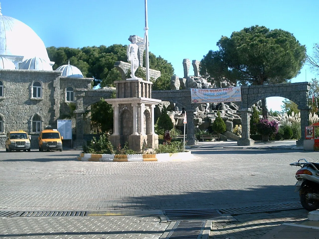
- Population
- 73,260
- 73.3K
- Elevation
- 9 m
- above sea level
- Local time
- UTC+03:00
- Europe/Istanbul · UTC+03:00
- Airports
- AYT Antalya International Airport24 km
- ISE Süleyman Demirel International Airport126 km
About Belek
Belek is a town. Location: Serik, Antalya Province. Population: 73,260. Elevation: 9 m.
Belek is a neighbourhood in the Serik district in Turkey's Antalya Province. As of 2022, it had a population of 9,102. Before the 2013 Turkish local government reorganization, it was a town (Belde). Belek is one of the centers of Turkey's tourism industry and is home to more than thirty four-star and five-star hotels and many other accommodation services and entertainment facilities. The town and the surrounding area are famous for their spas and mineral waters received from seven springs.
Source: Wikipedia · CC BY-SA 4.0
Photos of Belek
-

Eugene Yakovenko · CC BY-SA 3.0 -

Eugene Yakovenko · CC BY-SA 3.0 -

King Otto · CC BY-SA 3.0 -

King Otto · CC BY-SA 3.0 -

Хомелка · CC BY-SA 4.0


Travel notes for Belek
From Wikivoyage
Belek is a beach resort in Pamphylia on the Mediterranean coast of Turkey, about 40 km east of Antalya. Its big selling point is golf - some dozen courses line the coast, and Turkey's principal tournament is held here as part of the European Tour.
The nearby ruined cities of Aspendos and Perge indicate the ancient civilisations of this area, but Belek lacks a harbour or defensible redoubt, so it was unimportant until modern times. It's governed as part of Serik town within Antalya Province, and in 2022 had a population of 9102. It includes the neighbourhoods of Kadriye and Boğazkent.
Get in+
See Antalya for long-distance travel routes. International visitors mostly arrive at the airport (AYT IATA) and are bussed the 40 km direct to their hotels. Independent travellers might hire a car there or take a taxi, since the airport is east of the city and you can avoid backtracking via downtown.
Bus BA22 runs from Antalya Meydan to Belek and Boğazkent every 20 min from 06:20 to 21:30. You need the Antalyakart public transport card to use this or any other city bus, see Antalya#Get around for details. Or look for a dolmuş.
Buses between Antalya, Manavgat (for Side) and Alanya scoot past on D400 inland and don't come in to Belek. You could get off at Serik and find a taxi or dolmuş.
Source: Wikivoyage · CC BY-SA 4.0 · abridged
Places bordering Belek
- Kadriye
- Aşağıçatma
- Boğazkent
Climate of Belek
Best months for sightseeingBest months for sightseeing: April–May.
This month · November
A wet month
Day 21° · Night 9° · Rain 119 mm
Better nearby cities in November
- Alanya · 91 km southeast21°
- Silifke · 262 km east21°
- Aydin · 305 km west19°
- Hottest month
- July (day 35°)
- Coldest month
- January (night 4°)
- Wettest month
- December (179 mm)
- Driest month
- July (7 mm)
Bars: average monthly low and high temperature. Below: precipitation. Monthly averages for 1970–2000 at about 18 km resolution, adjusted for elevation. Highlighted months are mild and relatively dry. Source: WorldClim 2.1 (CC BY 4.0).
Show values as a table
| Month | Jan | Feb | Mar | Apr | May | Jun | Jul | Aug | Sep | Oct | Nov | Dec |
|---|---|---|---|---|---|---|---|---|---|---|---|---|
| Average high (°C) | 14° | 15° | 18° | 22° | 27° | 32° | 35° | 35° | 32° | 27° | 21° | 16° |
| Average low (°C) | 4° | 5° | 7° | 10° | 14° | 18° | 21° | 21° | 17° | 13° | 9° | 6° |
| Precipitation (mm) | 167 | 128 | 76 | 46 | 32 | 15 | 7 | 12 | 15 | 68 | 119 | 179 |
How to get to Belek
The nearest airport is Antalya International Airport (AYT), 24 km to the west as the crow flies. The nearest large city is Muratpaşa, 27 km to the west.
Airports
- Antalya International Airport (AYT) Antalya 24 kmwest
- Süleyman Demirel International Airport (ISE) Isparta 126 kmnorthwest
- Gazipaşa-Alanya Airport (GZP) Gazipaşa 127 kmsoutheast
Nearby large cities
- Muratpaşa Population: 450K 27 kmwest
- Antalya Population: 1.3M 33 kmwest
- Alanya Population: 364.2K 91 kmsoutheast
- Isparta Population: 172.3K 110 kmnorthwest
- Konya Population: 1.4M 168 kmnortheast
Straight-line distances; road distances are longer. Airport data: OurAirports.
Day trips from Belek
Within 100 km: 86 historic and cultural sites, 1,696 natural sites, 228 lakes, rivers and coasts.
0–25 km280 places
- Kumköy Plajı Beach 12 kmW
- Özlü Plajı Beach 13 kmW
- Lara Plajları Beach 21 kmW
- Koca Gölü Lake 9 kmE
25–60 km703 places
- Çenger Mevki, Side, Manavgat/Antalya Beach 53 kmE
- Konyaaltı Plajı Beach 38 kmW
- Bambus Plajı Beach 30 kmW
- Sıçan Adası Island 43 kmW
60–100 km1,027 places
- Kleopatra Beach Beach 88 kmSE
- Kumsal Halk Plajı Beach 92 kmSE
- Damlatas Beach 89 kmSE
- İncekum Beach 66 kmE
Straight-line distances.
Belek and similar cities
Side by side with cities of similar size in the same country: population, elevation and climate.
| Measure | Belek | Tatvan | Çınar | Bilecik |
|---|---|---|---|---|
| Population | 73.3K | 73.2K | 74.2K | 74.5K |
| Elevation | 9 m | 1,682 m | 658 m | 517 m |
| Summer day (hottest month) | 35° | 29° | 39° | 28° |
| Winter night (coldest month) | 4° | -5° | -2° | -1° |
| Annual rainfall | 864 mm | 859 mm | 544 mm | 530 mm |
| Best months | Apr–May | Jun, Sep | Apr–May, Oct | May–Oct |
| Distance | — | 1,005 km | 833 km | 376 km |
Climate values are 1970–2000 monthly averages; straight-line distance.
Nearby attractions & nature
Everything nearby-
Nevruzçamı Tepesi Mountain, Serik1 km S
-
Kocaboynuzlar Tepesi Mountain, Serik1.4 km S
-
Çilekli Tepe Mountain, Serik2.2 km W
-
İleribaşı Tepesi Mountain, Serik2.2 km SE
-
Damyerleri Tepesi Mountain, Serik2.3 km SE
-
Batak Deresi River, Antalya Province1.9 km E
-
Kocapelitler Tepesi Mountain, Serik3.2 km NE
-
Yassıyusuflar Tepesi Mountain, Serik3.3 km NE
Sources & licences
Data last updated: · 2 independent sources