Halfeti Bucağı
Located in Gaziantep Province, Turkey Coordinates: 37°14′18″ N 37°51′41″ E
- Elevation
- 504 m
- above sea level
- Local time
- UTC+03:00
- Europe/Istanbul · UTC+03:00
- Airports
- GZT Gaziantep Oğuzeli International Airport47 km
- ADF Adıyaman Airport77 km
About Halfeti Bucağı
Halfeti Bucağı is a municipality. Location: Gaziantep Province, Turkey. Elevation: 504 m. The best months to visit are April, October. The nearest airport is Gaziantep Oğuzeli International Airport (47 km). Nearby sights include Merziman Çayı and Rum Kalesi.
Climate of Halfeti Bucağı
Best months for sightseeingBest months for sightseeing: April, October.
This month · November
Outside the best season
Day 18° · Night 6° · Rain 49 mm
Better nearby cities in November
- Suruç · 58 km southeast20°
- Osmaniye · 144 km west21°
- İskenderun · 167 km southwest22°
- Hottest month
- July (day 39°)
- Coldest month
- January (night 1°)
- Wettest month
- December (89 mm)
- Driest month
- August (1 mm)
Bars: average monthly low and high temperature. Below: precipitation. Monthly averages for 1970–2000 at about 18 km resolution, adjusted for elevation. Highlighted months are mild and relatively dry. Source: WorldClim 2.1 (CC BY 4.0).
Show values as a table
| Month | Jan | Feb | Mar | Apr | May | Jun | Jul | Aug | Sep | Oct | Nov | Dec |
|---|---|---|---|---|---|---|---|---|---|---|---|---|
| Average high (°C) | 10° | 12° | 17° | 23° | 29° | 35° | 39° | 39° | 35° | 27° | 18° | 12° |
| Average low (°C) | 1° | 2° | 5° | 9° | 14° | 19° | 22° | 22° | 17° | 11° | 6° | 3° |
| Precipitation (mm) | 83 | 67 | 64 | 46 | 29 | 5 | 2 | 1 | 3 | 30 | 49 | 89 |
How to get to Halfeti Bucağı
The nearest airport is Gaziantep Oğuzeli International Airport (GZT), 47 km to the southwest as the crow flies. The nearest large city is Gaziantep, 47 km to the southwest.
Airports
- Gaziantep Oğuzeli International Airport (GZT) Gaziantep 47 kmsouthwest
- Adıyaman Airport (ADF) Adıyaman 77 kmnortheast
- Kahramanmaraş Airport (KCM) Kahramanmaraş 87 kmnorthwest
Straight-line distances; road distances are longer. Airport data: OurAirports.
Day trips from Halfeti Bucağı
Within 100 km: 48 historic and cultural sites, 408 natural sites, 192 lakes, rivers and coasts.
0–25 km23 places
- Kızıl Dağ Mountain 10 kmSE
- Sarıyaprak Dağı Mountain 18 kmW
- Alaburun Tepe Mountain 13 kmNW
- Askerhöyüğü Tepe Mountain 18 kmNW
25–60 km235 places
- Kayacıik Barajı Lake 58 kmSW
- Yumaklı Tepe Mountain 48 kmNW
- Yarım Tepe Mountain 43 kmNE
- Mazılık Tepe Mountain 30 kmN
60–100 km390 places
- Sazlıca Gölü Lake 97 kmN
- Kara Göl Lake 99 kmW
- İnekli Göl Lake 60 kmNW
- Burç Göleti Lake 65 kmW
Straight-line distances.
Nearby attractions & nature
Everything nearby-
Merziman Çayı River, Gaziantep Province4.3 km NW
-
Rum Kalesi Historic site, Yavuzeli İlçesi4.1 km NW
-
Sinekli Dere River, Şanlıurfa Province4.6 km N
-
Çekem Dağı Mountain, Halfeti District7 km S
-
Erenköy Dere River, Gaziantep Province8.3 km S
-
Sarıçiçek Düzü Natural site, Şanlıurfa Province9.9 km NE
-
Akmezraa Deresi River, Gaziantep Province9.2 km NW
-
Kızıl Dağ Mountain, Birecik District10 km SE
Other cities and towns in Gaziantep Province
-
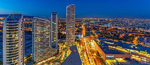 Gaziantep City, Gaziantep Province47 km SW
-
Nizip City, Nizip İlçesi26 km S
-
Araban City, Araban26 km NW
-
Yavuzeli City, Yavuzeli İlçesi27 km W
-
Karacaören Town, Araban31 km NW
-
Araban Bucağı Municipality, Gaziantep Province26 km NW
Sources & licences
Data last updated: